Difference between revisions of "2013-04-13 63 28"
imported>Pastori (Pastori's third successfull trip, snow shoes still needed on these latitudes.) |
imported>FippeBot m (Location) |
||
| (One intermediate revision by one other user not shown) | |||
| Line 38: | Line 38: | ||
}} | }} | ||
| − | |||
| − | |||
| − | |||
[[Category:Expeditions]] | [[Category:Expeditions]] | ||
[[Category:Expeditions with photos]] | [[Category:Expeditions with photos]] | ||
[[Category:Coordinates reached]] | [[Category:Coordinates reached]] | ||
| + | {{location|FI|13}} | ||
Latest revision as of 01:51, 14 August 2019
| Sat 13 Apr 2013 in 63,28: 63.7294879, 28.6855494 geohashing.info google osm bing/os kml crox |
Location
In Rasimäki, Valtimo, near the house Tornio.
Participants
- Pastori
- The Wife
Plans
Recently we have been getting a lot of good hashpoints near where we live. Again only a few kilometers, and the place is easy, too, almost directly on a road. A must visit!
Expedition
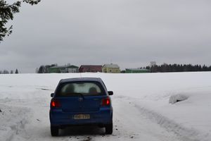
Despite the rainy morning we left for the hashpoint, had about 5 km to go with a car. Temperature on the plus side and the rain had taken away the good conditions for skiing that had prevailed several weeks. Otherwise Pastori would most likely have gone all the way to the hashpoint with skis.
The road took us directly through one neighbour's house's yard, thus we had to stop for a chat with the master of the house. (Here in the sparsely populated regions all who live about 5 kilometers from each other are considered neighbours.) We told him about geohashing, so now the whole village knows about it! Well, never mind that.
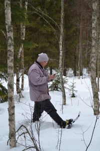
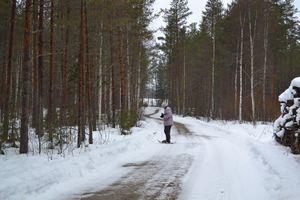
Neighbour told us they had kept the field roads ploughed because of logging going on in the woods behind them, so we got within 30 meters of the hashpoint with the car. We put snow shoes on and went out searching. Because of the trees apparently blocking the satellite reception we couldn't get a closer reading than 14 meters despite waiting for a while and initializing the search a couple of times. Well, can't help it. Definitely we were "there", because there were no that kind of obstacles that could have blocked the exact spot. There was mild rain the whole time, but it was a nice trip outside, if not for the geohashing we probably wouldn't have gone out the whole day.
Additional photos
Achievements
Pastori earned the Land geohash achievement
|


