Difference between revisions of "2013-04-28 51 12"
From Geohashing
imported>Bazaruto |
imported>FippeBot m (Location) |
||
| (4 intermediate revisions by one other user not shown) | |||
| Line 1: | Line 1: | ||
| − | |||
| − | |||
| − | |||
| − | |||
| − | |||
| − | |||
| − | |||
| − | |||
| − | |||
| − | |||
{{meetup graticule | {{meetup graticule | ||
| lat=51 | | lat=51 | ||
| Line 23: | Line 13: | ||
<!-- who attended: If you link to your wiki user name in this section, your expedition will be picked up by the various statistics generated for geohashing. You may use three tildes ~ as a shortcut to automatically insert the user signature of the account you are editing with. | <!-- who attended: If you link to your wiki user name in this section, your expedition will be picked up by the various statistics generated for geohashing. You may use three tildes ~ as a shortcut to automatically insert the user signature of the account you are editing with. | ||
--> | --> | ||
| − | [[User:Bazaruto|Bazaruto]] | + | [[User:Bazaruto|Bazaruto]] |
| − | |||
| − | |||
| − | |||
== Expedition == | == Expedition == | ||
<!-- how it all turned out. your narrative goes here. --> | <!-- how it all turned out. your narrative goes here. --> | ||
| − | + | A hash in walking distance! After months of waiting. But for it was a sunday morning, the walk could be shortened by bus. | |
| − | + | Back home I discovered the photo of the gps was nearly unreadable because of to much sun. But I was there. | |
| − | |||
== Photos == | == Photos == | ||
| Line 40: | Line 26: | ||
--> | --> | ||
<gallery perrow="5"> | <gallery perrow="5"> | ||
| + | Image:2013_04_28_51_12_grin.jpg | The grin | ||
| + | Image:2013_04_28_51_12_point.jpg | hashpoint | ||
| + | Image:2013_04_28_51_12_tomuchsun.jpg | To much sun on the gps. | ||
</gallery> | </gallery> | ||
| − | |||
| − | |||
| − | |||
| − | |||
| − | |||
<!-- Potential categories. Please include all the ones appropriate to your expedition --> | <!-- Potential categories. Please include all the ones appropriate to your expedition --> | ||
| − | |||
| − | |||
| − | |||
| − | |||
[[Category:Expeditions]] | [[Category:Expeditions]] | ||
| − | + | [[Category:Expeditions with photos]] | |
| − | [[Category:Expeditions with photos]] | ||
| − | |||
| − | |||
| − | |||
| − | |||
[[Category:Coordinates reached]] | [[Category:Coordinates reached]] | ||
| + | {{location|DE|SN|L|city=true}} | ||
Latest revision as of 02:05, 14 August 2019
| Sun 28 Apr 2013 in 51,12: 51.2958254, 12.4715725 geohashing.info google osm bing/os kml crox |
Location
Small wood near Holzhausen.
Participants
Expedition
A hash in walking distance! After months of waiting. But for it was a sunday morning, the walk could be shortened by bus.
Back home I discovered the photo of the gps was nearly unreadable because of to much sun. But I was there.
Photos

The grin
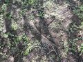
hashpoint
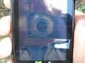
To much sun on the gps.


