Difference between revisions of "2013-05-13 33 -97"
imported>Neimster (Replaced content with "{{subst:Expedition |lat = 33 |lon = -97 |date = 2013-05-13 }}") |
imported>FippeBot m (Location) |
||
| (3 intermediate revisions by one other user not shown) | |||
| Line 1: | Line 1: | ||
| − | |||
| − | |||
| − | |||
| − | |||
| − | |||
| − | |||
| − | |||
| − | |||
| − | |||
{{meetup graticule | {{meetup graticule | ||
| lat=33 | | lat=33 | ||
| Line 15: | Line 6: | ||
}} | }} | ||
| − | |||
__NOTOC__ | __NOTOC__ | ||
== Location == | == Location == | ||
| − | + | The hash was is a field a few miles southeast of Gainesville, about 200 yards from a 2-lane [http://en.wikipedia.org/wiki/Farm-to-market_road farm-to-market road]. (Since many hashes in this area are located on agricultural land, travel on one of these is almost always necessary to reach the location.) This location was a relatively easy one to reach for me; even though it was about 30 miles away from where I live, about 25 of those could be done at 65 MPH with the help of the interstate. | |
== Participants == | == Participants == | ||
| − | + | *[[User:Neimster|Neimster]] | |
| − | |||
| − | |||
| − | |||
| − | |||
== Expedition == | == Expedition == | ||
| − | + | Upon arriving in the area, I parked the car and began searching for a way around the barbed-wire fence between me and the hash. No trespassing signs were not posted. Upon reaching a gate, I quickly climbed over it and into the field. Just as I began my final navigation toward the hash, I noticed that there stood a herd of cows, standing in the shade near the fence. I estimate they were about 30 feet away from me, and, not wanting to risk injury, I decided to abort the mission and climb back over the gate. | |
| − | |||
| − | |||
| − | |||
== Photos == | == Photos == | ||
| − | |||
| − | |||
| − | |||
<gallery perrow="5"> | <gallery perrow="5"> | ||
| + | Image:2013-05-13 33 -97 cows portrait.jpg | These are the cows. You can only see a couple in the picture, partly due to the poor lighting, but there were more. | ||
| + | Image:2013-05-13 33 -97 field.jpg | People often fail to recognize the beauty of an open field. | ||
| + | Image:2013-05-13_33_-97_map_screenshot.png | This is as close as I was able to get. | ||
| + | Image:2013-05-13_33_-97_stats_screenshot.png | Close enough that you couldn't tell based on the coordinates (rounded to the nearest 1000th of a degree). | ||
| + | Image:2013-05-13_33_-97_gas_station.jpg | While driving back through Gainesville, I happened upon some some sort of ancient ruins. | ||
</gallery> | </gallery> | ||
| − | |||
| − | |||
| − | |||
| − | |||
| − | |||
| − | |||
| − | |||
| − | |||
| − | |||
| − | |||
| − | |||
| − | |||
| − | |||
| − | |||
[[Category:Expeditions]] | [[Category:Expeditions]] | ||
| − | |||
[[Category:Expeditions with photos]] | [[Category:Expeditions with photos]] | ||
| − | |||
| − | |||
| − | |||
| − | |||
| − | |||
| − | |||
| − | |||
| − | |||
| − | |||
[[Category:Coordinates not reached]] | [[Category:Coordinates not reached]] | ||
| − | |||
| − | |||
[[Category:Not reached - Mother Nature]] | [[Category:Not reached - Mother Nature]] | ||
| − | + | {{location|US|TX|OO}} | |
| − | |||
| − | |||
| − | |||
| − | |||
| − | |||
| − | |||
| − | |||
| − | |||
| − | |||
| − | |||
Latest revision as of 02:19, 14 August 2019
| Mon 13 May 2013 in 33,-97: 33.5722309, -97.0394874 geohashing.info google osm bing/os kml crox |
Location
The hash was is a field a few miles southeast of Gainesville, about 200 yards from a 2-lane farm-to-market road. (Since many hashes in this area are located on agricultural land, travel on one of these is almost always necessary to reach the location.) This location was a relatively easy one to reach for me; even though it was about 30 miles away from where I live, about 25 of those could be done at 65 MPH with the help of the interstate.
Participants
Expedition
Upon arriving in the area, I parked the car and began searching for a way around the barbed-wire fence between me and the hash. No trespassing signs were not posted. Upon reaching a gate, I quickly climbed over it and into the field. Just as I began my final navigation toward the hash, I noticed that there stood a herd of cows, standing in the shade near the fence. I estimate they were about 30 feet away from me, and, not wanting to risk injury, I decided to abort the mission and climb back over the gate.
Photos

These are the cows. You can only see a couple in the picture, partly due to the poor lighting, but there were more.

People often fail to recognize the beauty of an open field.

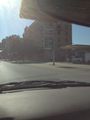
This is as close as I was able to get.

Close enough that you couldn't tell based on the coordinates (rounded to the nearest 1000th of a degree).
While driving back through Gainesville, I happened upon some some sort of ancient ruins.


