Difference between revisions of "2013-07-21 60 21"
imported>Nebini (Template and initial plans) |
imported>Nebini (shot report) |
||
| Line 19: | Line 19: | ||
== Location == | == Location == | ||
| − | Near shoreline in dry pine forest. According to property division map point | + | Masku, Finland. Near shoreline in dry pine forest. According to property division map point is on a vacant lot between 2 summer cottages. |
== Participants == | == Participants == | ||
| Line 30: | Line 30: | ||
== Expedition == | == Expedition == | ||
| − | + | During weekend I was visiting my friends near Turku. Unfortunately I wasn't able to persuade any of my friends to join me. The whole journey was uneventful, travel 10 km by car and then last 500 meters by foot. Neither of the cottages were occupied at the time of the expedition. Since the weather was perfect I was prepared to explain geohashing to cottage dwellers. | |
| − | + | Horses, blueberries and over ripe blueberries were encountered on the way. | |
| − | + | ||
| + | General area was easy to reach, but pinpointing the actual spot was a little tricky with awkwardly seldom updating GPS-application. | ||
== Photos == | == Photos == | ||
| − | |||
| − | |||
| − | |||
<gallery perrow="5"> | <gallery perrow="5"> | ||
| + | Image:2013-07-21_60_21_face.jpg | Nebini posing | ||
| + | Image:2013-07-21_60_21_position.JPG | Only a few steps from the actual hashpoint | ||
| + | Image:2013-07-21_60_21_raspberries.jpg | wild raspberries | ||
</gallery> | </gallery> | ||
== Achievements == | == Achievements == | ||
{{#vardefine:ribbonwidth|800px}} | {{#vardefine:ribbonwidth|800px}} | ||
| − | + | {{Virgin graticule | |
| + | | latitude = 60 | ||
| + | | longitude = 21 | ||
| + | | date = 2013-07-21 | ||
| + | | name = [[User:Nebibi|Nebini]] | ||
| + | | image = 2013-07-21_60_21_face.jpg | ||
| + | }} | ||
| − | |||
| − | |||
[[Category:New report]] | [[Category:New report]] | ||
| − | |||
| − | |||
| − | |||
| − | |||
[[Category:Expeditions]] | [[Category:Expeditions]] | ||
| − | |||
[[Category:Expeditions with photos]] | [[Category:Expeditions with photos]] | ||
| − | |||
| − | |||
| − | |||
| − | |||
| − | |||
[[Category:Coordinates reached]] | [[Category:Coordinates reached]] | ||
| − | |||
| − | |||
| − | |||
| − | |||
| − | |||
| − | |||
| − | |||
| − | |||
| − | |||
| − | |||
| − | |||
| − | |||
| − | |||
| − | |||
| − | |||
| − | |||
| − | |||
| − | |||
Revision as of 13:57, 24 July 2013
| Sun 21 Jul 2013 in 60,21: 60.5081489, 21.9933500 geohashing.info google osm bing/os kml crox |
Location
Masku, Finland. Near shoreline in dry pine forest. According to property division map point is on a vacant lot between 2 summer cottages.
Participants
Plans
No special plans. I'll try to reach the point around noon.
Expedition
During weekend I was visiting my friends near Turku. Unfortunately I wasn't able to persuade any of my friends to join me. The whole journey was uneventful, travel 10 km by car and then last 500 meters by foot. Neither of the cottages were occupied at the time of the expedition. Since the weather was perfect I was prepared to explain geohashing to cottage dwellers.
Horses, blueberries and over ripe blueberries were encountered on the way.
General area was easy to reach, but pinpointing the actual spot was a little tricky with awkwardly seldom updating GPS-application.
Photos
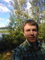
Nebini posing
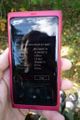
Only a few steps from the actual hashpoint
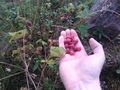
wild raspberries


