Difference between revisions of "2013-08-21 54 25"
imported>Calamus m (Categorizing) |
imported>Nebini (→Expedition) |
||
| Line 33: | Line 33: | ||
Coordinates reached just after sunset. | Coordinates reached just after sunset. | ||
| − | Actual hashpoint was "only" 350m from the nearest cyclable road | + | Actual hashpoint was "only" 350m from the nearest cyclable road. The expedition took way longer than originally planned because the bike broke on the way to the hashpoint. |
| − | The | + | 18:30 |
| + | [[Image:2013-08-21_54_25_hire_a_bike_1.jpeg|200px|Hiring a bike]] | ||
| + | [[Image:2013-08-21_54_25_hire_a_bike_2.jpeg|200px|Bike rental is in the basement]] | ||
| + | The expedition started by renting a bike from a bike rental. http://velovilnius.lt/ Price for one day was 40 Lt and the down payment for not returning the bike was 200€. The staring place was about 50 meters from Aušros Vartai. | ||
| + | 19:00 | ||
| + | [[Image:2013-08-21_54_25_road_accident.jpeg|200px|traffic accident]] Encountered a road accident. A too tall truck had knocked a steel bar out of place. Hopefully the bridge following the bar was not damaged. There was a long queue of cars. Biking conditions were quite good. The biking lanes were paved. At this point it looked that the trip would be over around 10pm. | ||
| + | |||
| + | 19:30 | ||
| + | [[Image:2013-08-21_54_25_leaving_vilnius.jpeg|200px]] | ||
| + | Leaving Vilnius county. Almost no effort has to be exerted, a gentle downhill continued for many kilometers. It seems that cars on the road are not accustomed to bikes. Few cars passed way too close. On Eišiškių plentas road. | ||
| + | |||
| + | 19:50 | ||
| + | [[Image:2013-08-21_54_25_typical_scenery.jpeg|200px]] | ||
| + | Some typical scenery as seen from the road 202. Probably in Pagiriai. | ||
== Photos == | == Photos == | ||
Revision as of 22:58, 6 April 2014
| Wed 21 Aug 2013 in 54,25: 54.5057897, 25.1128616 geohashing.info google osm bing/os kml crox |
Location
In pine forest, about 20 km south from the old town of Vilnius.
Participants
Plans
- Nebini will try to reach the hashpoint
- Hire a bicycle from somewhere and get there.
Expedition
Coordinates reached just after sunset.
Actual hashpoint was "only" 350m from the nearest cyclable road. The expedition took way longer than originally planned because the bike broke on the way to the hashpoint.
18:30
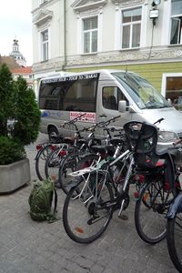
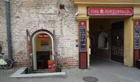 The expedition started by renting a bike from a bike rental. http://velovilnius.lt/ Price for one day was 40 Lt and the down payment for not returning the bike was 200€. The staring place was about 50 meters from Aušros Vartai.
19:00
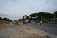 Encountered a road accident. A too tall truck had knocked a steel bar out of place. Hopefully the bridge following the bar was not damaged. There was a long queue of cars. Biking conditions were quite good. The biking lanes were paved. At this point it looked that the trip would be over around 10pm.
19:30
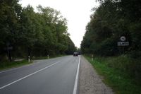 Leaving Vilnius county. Almost no effort has to be exerted, a gentle downhill continued for many kilometers. It seems that cars on the road are not accustomed to bikes. Few cars passed way too close. On Eišiškių plentas road.
19:50
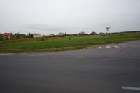 Some typical scenery as seen from the road 202. Probably in Pagiriai.
Photos
Achievements
- Land geohash