Difference between revisions of "2013-08-23 67 24"
From Geohashing
imported>Isopekka (Created page with "thumb|left {{meetup graticule | lat=67 | lon=24 | date=2013-08-23 }} == Location == At Kittilä (Kaukonen), about 120 meters from the main road, ...") |
imported>FippeBot m (Location) |
||
| Line 82: | Line 82: | ||
[[Category:Expeditions with photos]] | [[Category:Expeditions with photos]] | ||
[[Category:Coordinates reached]] | [[Category:Coordinates reached]] | ||
| + | {{location|FI|10}} | ||
Revision as of 03:40, 14 August 2019
| Fri 23 Aug 2013 in 67,24: 67.4573643, 24.9493154 geohashing.info google osm bing/os kml crox |
Contents
Location
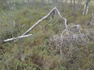
At Kittilä (Kaukonen), about 120 meters from the main road, on the swamp.
Participants
Expedition
- Walking total 0.3 km
- Expedition took 0.25 h
- Physical effort (1-5): 1
I was driving to my cottage and this hash was very near the main road. So it was extremely easy one.
Photos
- Proof.jpg
The Proof.
Achievements
isopekka earned the Land geohash achievement
|
isopekka achieved level 5 of the Minesweeper Geohash achievement
|
Geohashing Expeditions and Plans on This Day
Expeditions and Plans
| 2013-08-23 | ||
|---|---|---|
| Deming, New Mexico | Someone went | East of Silver City, North of Demming, West of Hatch...actually not too far... |
| Atlanta, Georgia | NWoodruff | On an undeveloped lot of a subdivision in Cliftondale just west of Atlanta ... |
| Boise, Idaho | Eldin, Ojones | In an empty field at the edge of Nampa |
| Portland, Oregon | Frogman, Michael5000, Alison | Someone's driveway in the Oakbrook neighborhood of Vancouver, WA. |
| Tours, France | Dunaril, Katu | Inside a little forest in Montreuil-en-Touraine, north of Amboise and the L... |
| Chartres, France | Dunaril, Katu | An open field in Authon-la-Plaine, very close to the A10 between Paris and ... |
| Kittilä, Finland | isopekka | At Kittilä (Kaukonen), about 120 meters from the main road, on the swamp. |


