Difference between revisions of "2013-10-16 51 9"
imported>GeorgDerReisende (new expedition to Lutterberg) |
imported>GeorgDerReisende (expedition report added) |
||
| Line 20: | Line 20: | ||
== Expedition == | == Expedition == | ||
| − | + | ||
| + | I started at home at12:30, took two trams to the Platz der Deutschen Einheit. There I took the bus 30 to Sichelnstein, where I arrived at 13:45. From there I walked to and into the forest. The weather was wet, either by fog or by low flying clouds. There was no rain. After four kilometers I found the hash in the forest. There was a broken fence, which means a public path. Then I walked to Lutterberg. | ||
| + | |||
| + | On the way happened what I have always feared for: in all forests I have ever walked in while geohashing, there had been those forest roads with deep muddy tracks, where I don't like to walk in. I had to walk along such a road while crossing a vale on a dam. And there it happened: I slipped in such a track and suddenly I stood until the ankles in mud and until the knees in water. | ||
| + | |||
| + | At the end of the forest I found a closed gate, but the key of it was tieed to the gatepost. | ||
== Tracklog == | == Tracklog == | ||
| Line 30: | Line 35: | ||
--> | --> | ||
<gallery perrow="5"> | <gallery perrow="5"> | ||
| + | Image:2013-10-16 51 9 GeorgDerReisende 1617.jpg | start at the Platz der Deutschen Einheit | ||
| + | Image:2013-10-16 51 9 GeorgDerReisende 1621.jpg | foggy weather | ||
| + | Image:2013-10-16 51 9 GeorgDerReisende 1627.jpg | forest 1 | ||
| + | Image:2013-10-16 51 9 GeorgDerReisende 1635.jpg | forest 2 | ||
| + | Image:2013-10-16 51 9 GeorgDerReisende 1644.jpg | forest 3 | ||
| + | Image:2013-10-16 51 9 GeorgDerReisende 1649.jpg | forest 4 | ||
| + | Image:2013-10-16 51 9 GeorgDerReisende 1705.jpg | forest 5 | ||
| + | Image:2013-10-16 51 9 GeorgDerReisende 1707.jpg | forest 6 | ||
| + | Image:2013-10-16 51 9 GeorgDerReisende 1727.jpg | the hash is in the wood to the left | ||
| + | Image:2013-10-16 51 9 GeorgDerReisende 1731.jpg | along a fence is a path | ||
| + | Image:2013-10-16 51 9 GeorgDerReisende 1744.jpg | a small hill moor | ||
| + | Image:2013-10-16 51 9 GeorgDerReisende 1746.jpg | prrof 1 | ||
| + | Image:2013-10-16 51 9 GeorgDerReisende 1752.jpg | proof 2 | ||
| + | Image:2013-10-16 51 9 GeorgDerReisende 1747.jpg | the hash | ||
| + | Image:2013-10-16 51 9 GeorgDerReisende 1749.jpg | view into the forest | ||
| + | Image:2013-10-16 51 9 GeorgDerReisende 1751.jpg | view to the path | ||
| + | Image:2013-10-16 51 9 GeorgDerReisende 1753.jpg | grrin | ||
| + | Image:2013-10-16 51 9 GeorgDerReisende 1756.jpg | the internet was here! | ||
| + | Image:2013-10-16 51 9 GeorgDerReisende 1837.jpg | the closed gate | ||
| + | Image:2013-10-16 51 9 GeorgDerReisende 1836.jpg | the key | ||
</gallery> | </gallery> | ||
| Line 36: | Line 61: | ||
<!-- Add any achievement ribbons you earned below, or remove this section --> | <!-- Add any achievement ribbons you earned below, or remove this section --> | ||
| + | {{Public transport geohash | latitude = 51 | longitude = 9 | date = 2013-10-16 | busline = bus 30 | name = GeorgDerReisende }} | ||
| − | + | [[Category:Expeditions]] | |
| − | |||
| − | [[Category: | ||
| − | + | [[Category:Expeditions with photos]] | |
| − | |||
| − | [[Category: | ||
| − | |||
| − | |||
| − | |||
| − | |||
| − | |||
| − | |||
| − | |||
| − | |||
| − | |||
| − | |||
[[Category:Coordinates reached]] | [[Category:Coordinates reached]] | ||
| − | |||
| − | |||
| − | |||
| − | |||
| − | |||
| − | |||
| − | |||
| − | |||
| − | |||
| − | |||
| − | |||
| − | |||
| − | |||
| − | |||
| − | |||
| − | |||
| − | |||
| − | |||
Revision as of 19:27, 16 October 2013
| Wed 16 Oct 2013 in 51,9: 51.3688654, 9.6608392 geohashing.info google osm bing/os kml crox |
Location
in the forest about 2 km east of Lutterberg
Participants
Plans
I want to go to Lutterberg by bus and then I want to go to the hash. On the way home it may be possible to hitchhike.
Expedition
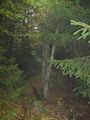
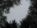
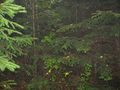
I started at home at12:30, took two trams to the Platz der Deutschen Einheit. There I took the bus 30 to Sichelnstein, where I arrived at 13:45. From there I walked to and into the forest. The weather was wet, either by fog or by low flying clouds. There was no rain. After four kilometers I found the hash in the forest. There was a broken fence, which means a public path. Then I walked to Lutterberg.
On the way happened what I have always feared for: in all forests I have ever walked in while geohashing, there had been those forest roads with deep muddy tracks, where I don't like to walk in. I had to walk along such a road while crossing a vale on a dam. And there it happened: I slipped in such a track and suddenly I stood until the ankles in mud and until the knees in water.
At the end of the forest I found a closed gate, but the key of it was tieed to the gatepost.
Tracklog
Photos
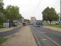
start at the Platz der Deutschen Einheit
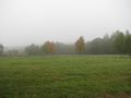
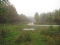
foggy weather
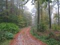
forest 1
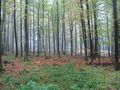
forest 2
forest 3
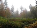
forest 4
forest 5
forest 6
the hash is in the wood to the left
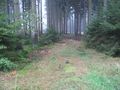
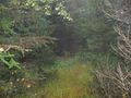
along a fence is a path
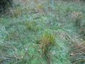
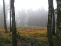
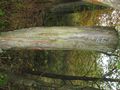
a small hill moor
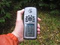
prrof 1
proof 2
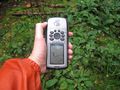
the hash
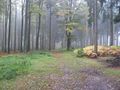
view into the forest
view to the path
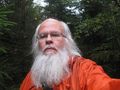
grrin
the internet was here!
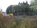
the closed gate
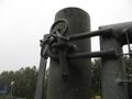
the key


Achievements
GeorgDerReisende earned the Public transport geohash achievement
|