Difference between revisions of "2013-10-28 -34 138"
imported>Mrbrennan (→Plans) |
imported>BrendanTWhite (→Participants) |
||
| Line 25: | Line 25: | ||
<!-- who attended: If you link to your wiki user name in this section, your expedition will be picked up by the various statistics generated for geohashing. You may use three tildes ~ as a shortcut to automatically insert the user signature of the account you are editing with. | <!-- who attended: If you link to your wiki user name in this section, your expedition will be picked up by the various statistics generated for geohashing. You may use three tildes ~ as a shortcut to automatically insert the user signature of the account you are editing with. | ||
--> | --> | ||
| − | Just [[User: | + | Just [[User:BrendanTWhite|Brendan]]. Nobody else. :-( |
== Plans == | == Plans == | ||
Revision as of 11:56, 28 October 2013
| Mon 28 Oct 2013 in -34,138: -34.9409902, 138.6599519 geohashing.info google osm bing/os kml crox |
Location
559 Glynburn Road, Hazelwood Park. Just a suburban house, really. The actual point was in the back yard somewhere, and I don't know the people who live there, so I didn't go in.
Participants
Just Brendan. Nobody else. :-(
Plans
I was thinking about geohashing last night, and this morning when I saw the location I thought - cool. A location that's close enough to get to, on a day when I don't have to go to work, and I have a half hour when I don't have any other stuff I need to get done.
Expedition
Just drove ... dropped the wifey off at a physio appointment, and had 30 minutes to kill.
Tracklog
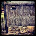
I don't actually have a tracklog (unless you count the metadata in the iPhone / Instragram photo), nor proof of date (again unless you count the photo metadata).
Pity, I might have gotten the Land geohash achievement... if I'd had my StupidGrinTM in the photo...
Photos
Achievements
