Difference between revisions of "2013-12-09 47 -122"
From Geohashing
imported>Thomcat ([live picture] View of the building [http://www.openstreetmap.org/?lat=47.76129435&lon=-122.19365567&zoom=16&layers=B000FTF @47.7613,-122.1937]) |
imported>Thomcat ([live picture] View from hashpoint [http://www.openstreetmap.org/?lat=47.76121557&lon=-122.19352173&zoom=16&layers=B000FTF @47.7612,-122.1935]) |
||
| Line 30: | Line 30: | ||
Image:2013-12-09_47_-122_08-02-20-182.jpg | View of the building [http://www.openstreetmap.org/?lat=47.76129435&lon=-122.19365567&zoom=16&layers=B000FTF @47.7613,-122.1937] | Image:2013-12-09_47_-122_08-02-20-182.jpg | View of the building [http://www.openstreetmap.org/?lat=47.76129435&lon=-122.19365567&zoom=16&layers=B000FTF @47.7613,-122.1937] | ||
| + | |||
| + | Image:2013-12-09_47_-122_08-05-10-715.jpg | View from hashpoint [http://www.openstreetmap.org/?lat=47.76121557&lon=-122.19352173&zoom=16&layers=B000FTF @47.7612,-122.1935] | ||
</gallery> | </gallery> | ||
Revision as of 16:05, 9 December 2013
| Mon 9 Dec 2013 in Seattle: 47.7612210, -122.1935631 geohashing.info google osm bing/os kml crox |
Location
Across the street from Cascadia CC near Bothell (and Woodinville).
Participants
Plans
Drive-by on the way to work; full expedition in the afternoon (around 3-4).
Expedition
Tracklog
Photos
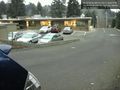
View of the building @47.7613,-122.1937
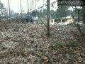
View from hashpoint @47.7612,-122.1935


Achievements