Difference between revisions of "2014-01-13 -12 130"
imported>Felix Dance (added virgin achievement) |
imported>Felix Dance m |
||
| Line 4: | Line 4: | ||
| date=2014-01-13 | | date=2014-01-13 | ||
}} | }} | ||
| − | |||
__NOTOC__ | __NOTOC__ | ||
Revision as of 09:53, 5 March 2014
| Mon 13 Jan 2014 in -12,130: -12.4901723, 130.9649453 geohashing.info google osm bing/os kml crox |
Location
In a school in Palmerston.
Participants
Expedition
I've been working up in Darwin the past three months or so, helping to build a gas plant for the Japanese, and up to now I'd been frustrated by lack of hashing up here, particularly since this graticule is not only virginal but also the last of the Australian capital cities to be deflowered.
On Sunday after work (I work on weekends because I'm still on a fly-in-fly-out roster from Melbourne) I rushed to the 3pm Mandorah ferry with my bike to cross Darwin Harbour and ride the 140kms back around to the city. Along the way there was a nearby geohash that looked... just out of reach. It would have involved detouring my road bike along a 4wd track and then bashing through kilometres of crocodile infested swampland during the rampaging storms of a cyclone build-up and I just... wasn't... quite... that... dedicated.
My consolation was that the next day a geohash fell in the comparatively nearby and accessible Darwinian suburb of Palmerston whose only detraction was that it's probably the most bogan postcode in all Australia. More to the point, rather than crocodile infested swampland, the hash was in the grounds of a school.
Pumping up my tires and jumping on my bike at 6pm after work on Monday off I rode along the old rail trail connecting Darwin and Palmerston. The rain hit early along this 27 km stretch and continued unabated for the rest of the ride (in fact it's still going the next day - the cyclone is drawing near). Handily, the rain is a nice warm shower - quite a change from the blistering cold of Melbourne's rain storms.
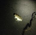
Skirting the wrong way round the circular suburb I at last arrived at the hash. It took about half an hour for my GPS to comply with reality and show me actually standing at the right spot. I pulled up stumps and rode back to my hotel, winding my bike around vast hordes of obstructing cane toads - vile pest of tropical Australia (I was told I should have aimed for them). My hotel chef kindly cooked me a rare steak upon my return.
I rode 54 kms and reached the hash at about 8pm.
Here is the route of my trip.
Photos
Felix Dance earned the Bicycle geohash achievement
|


