Difference between revisions of "2014-04-15 49 8"
imported>RecentlyChanged ([live picture] They are currently testing the fence :) ;) [http://www.openstreetmap.org/?lat=49.01835680&lon=8.30319643&zoom=16&layers=B000FTF @49.0184,8.3032]) |
imported>FippeBot m (Location) |
||
| (5 intermediate revisions by 3 users not shown) | |||
| Line 15: | Line 15: | ||
}} | }} | ||
| − | + | ||
__NOTOC__ | __NOTOC__ | ||
== Location == | == Location == | ||
| − | + | It was near the big river Rhein and easy to reach near a little street. | |
== Participants == | == Participants == | ||
| − | |||
| − | |||
| − | + | * [[User:Deuded|Deuded]] | |
| − | + | * [[User:RecentlyChanged|RecentlyChanged]] | |
== Expedition == | == Expedition == | ||
| − | |||
| Line 37: | Line 34: | ||
*The weather recently changed :( now its cold. But I will be there :) -- RecentlyChanged 18:03, 15 April 2014 (CEST) | *The weather recently changed :( now its cold. But I will be there :) -- RecentlyChanged 18:03, 15 April 2014 (CEST) | ||
| + | |||
| + | We made it around 100 meters near the hashpoint, but RecentlyChanged was sure it was on the east-west part of the rod. He was wrong, as deuded thought. <- That just counts for the no gps achievement, we used gps | ||
| + | |||
== Tracklog == | == Tracklog == | ||
| − | + | http://www.everytrail.com/view_trip.php?trip_id=2738729&code=263803941fb9633b8e91645e698c135f | |
== Photos == | == Photos == | ||
| − | |||
| − | |||
| − | |||
<gallery perrow="5"> | <gallery perrow="5"> | ||
| Line 55: | Line 52: | ||
Image:2014-04-15_49_8_RecentlyChanged_1397581580000.jpg | They are currently testing the fence :) ;) [http://www.openstreetmap.org/?lat=49.01835680&lon=8.30319643&zoom=16&layers=B000FTF @49.0184,8.3032] | Image:2014-04-15_49_8_RecentlyChanged_1397581580000.jpg | They are currently testing the fence :) ;) [http://www.openstreetmap.org/?lat=49.01835680&lon=8.30319643&zoom=16&layers=B000FTF @49.0184,8.3032] | ||
| + | |||
| + | Image:2014-04-15_49_8_deuded_1397581231862.jpg | Made it! | ||
</gallery> | </gallery> | ||
== Achievements == | == Achievements == | ||
{{#vardefine:ribbonwidth|800px}} | {{#vardefine:ribbonwidth|800px}} | ||
| − | |||
| + | {{land geohash | ||
| + | |||
| + | | latitude = 49 | ||
| + | | longitude = 8 | ||
| + | | date = 2014-04-15 | ||
| + | | name = deuded and RecentlyChanged | ||
| + | |||
| + | }} | ||
| + | {{bicycle geohash | ||
| + | |||
| + | | latitude = 49 | ||
| + | | longitude = 8 | ||
| + | | date = 2014-04-15 | ||
| + | | name = deuded and RecentlyChanged | ||
| + | | bothways = true | ||
| + | }} | ||
| − | |||
| − | |||
| − | |||
| − | |||
| − | |||
| − | |||
| − | |||
| − | |||
| − | |||
[[Category:Expeditions]] | [[Category:Expeditions]] | ||
| − | |||
[[Category:Expeditions with photos]] | [[Category:Expeditions with photos]] | ||
| − | |||
[[Category:Expedition without GPS]] | [[Category:Expedition without GPS]] | ||
| − | |||
| − | |||
| − | |||
[[Category:Coordinates reached]] | [[Category:Coordinates reached]] | ||
| − | + | {{location|DE|BW|KA|city=true}} | |
| − | |||
| − | |||
| − | |||
| − | |||
| − | |||
| − | |||
| − | |||
| − | |||
| − | |||
| − | |||
| − | |||
| − | |||
| − | |||
| − | |||
| − | |||
| − | |||
| − | |||
Latest revision as of 06:11, 14 August 2019
| Tue 15 Apr 2014 in 49,8: 49.0185983, 8.3031976 geohashing.info google osm bing/os kml crox |
Location
It was near the big river Rhein and easy to reach near a little street.
Participants
Expedition
- Perfect place, perfect weather! Hashing time! -- RecentlyChanged @49.0122,8.4123 10:50, 15 April 2014 (CEST)
- Sadly not as warm as yesterday. Where is summer?
Seems to be not very difficult to get there (I know you shouldn't say that :-P ) -- Deuded (talk) 11:57, 15 April 2014 (EDT)
- The weather recently changed :( now its cold. But I will be there :) -- RecentlyChanged 18:03, 15 April 2014 (CEST)
We made it around 100 meters near the hashpoint, but RecentlyChanged was sure it was on the east-west part of the rod. He was wrong, as deuded thought. <- That just counts for the no gps achievement, we used gps
Tracklog
http://www.everytrail.com/view_trip.php?trip_id=2738729&code=263803941fb9633b8e91645e698c135f
Photos
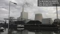
Beautiful scenery ;) @49.0168,8.3027
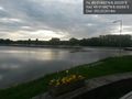
Close to the hash location, nice view of the rhein @49.0168,8.3027
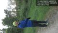
stupid grin from deuded showing us the hashpoint @49.0183,8.3033
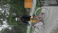
And RecentlyChanged @49.0186,8.3032
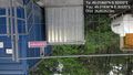
They are currently testing the fence :) ;) @49.0184,8.3032
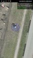
Made it!


Achievements
deuded and RecentlyChanged earned the Land geohash achievement
|
deuded and RecentlyChanged earned the Bicycle geohash achievement
|