Difference between revisions of "2014-05-09 51 14"
From Geohashing
imported>AmicaNoctis m (→Expedition) |
imported>Jiml m (Fix template coords to ints) |
||
| Line 15: | Line 15: | ||
}} | }} | ||
| − | + | ||
__NOTOC__ | __NOTOC__ | ||
== Location == | == Location == | ||
| − | + | ||
The today's hash is in a wheat field in the south-western end of Sohland (Spree), Saxony, Germany. | The today's hash is in a wheat field in the south-western end of Sohland (Spree), Saxony, Germany. | ||
== Participants == | == Participants == | ||
| − | + | ||
| − | + | * [[User:AmicaNoctis|AmicaNoctis]] and | |
| − | [[User:AmicaNoctis|AmicaNoctis]] | + | * significant other |
== Plans == | == Plans == | ||
| − | + | ||
| Line 33: | Line 33: | ||
== Expedition == | == Expedition == | ||
| + | |||
We set out by car towards Sohland and dropped the car on the Alte Dorfstraße near the location, walked uphill across an unfenced meadow and reached the field while being watched from a horse in an adjacent backyard. | We set out by car towards Sohland and dropped the car on the Alte Dorfstraße near the location, walked uphill across an unfenced meadow and reached the field while being watched from a horse in an adjacent backyard. | ||
We took some pictures and left the place for a stop-over at the reservoir. We missed it in the first place, since it was much smaller than expected, but arrived later during heavy rain. After almost half an hour of waiting we left our mobile shelter and had a look around at the water's edge and saw that the lake is used primarily for pedal boats, but not today. | We took some pictures and left the place for a stop-over at the reservoir. We missed it in the first place, since it was much smaller than expected, but arrived later during heavy rain. After almost half an hour of waiting we left our mobile shelter and had a look around at the water's edge and saw that the lake is used primarily for pedal boats, but not today. | ||
| − | == | + | == Photos == |
| − | |||
| − | |||
| − | |||
| − | |||
| − | |||
<gallery perrow="5"> | <gallery perrow="5"> | ||
Image:2014-05-09_51_14_AmicaNoctis_-1.jpg | Proof of arrival | Image:2014-05-09_51_14_AmicaNoctis_-1.jpg | Proof of arrival | ||
| − | |||
Image:2014-05-09_51_14_AmicaNoctis_1399645357716.jpg | Rain is coming and giving a dramatic scene | Image:2014-05-09_51_14_AmicaNoctis_1399645357716.jpg | Rain is coming and giving a dramatic scene | ||
| − | |||
Image:2014-05-09_51_14_AmicaNoctis_1399647731175.jpg | The nearby reservoir "Stausee Sohland" | Image:2014-05-09_51_14_AmicaNoctis_1399647731175.jpg | The nearby reservoir "Stausee Sohland" | ||
</gallery> | </gallery> | ||
| Line 55: | Line 49: | ||
== Achievements == | == Achievements == | ||
{{#vardefine:ribbonwidth|800px}} | {{#vardefine:ribbonwidth|800px}} | ||
| − | + | ||
{{land geohash | {{land geohash | ||
| − | | latitude = 51 | + | | latitude = 51 |
| − | | longitude = 14 | + | | longitude = 14 |
| date = 2014-05-09 | | date = 2014-05-09 | ||
| name = AmicaNoctis | | name = AmicaNoctis | ||
Revision as of 12:46, 3 June 2014
| Fri 9 May 2014 in 51,14: 51.0403556, 14.4091033 geohashing.info google osm bing/os kml crox |
Location
The today's hash is in a wheat field in the south-western end of Sohland (Spree), Saxony, Germany.
Participants
- AmicaNoctis and
- significant other
Plans
- I'll try to visit this hash today at 4pm Berlin time. -- AmicaNoctis
Expedition
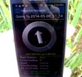
We set out by car towards Sohland and dropped the car on the Alte Dorfstraße near the location, walked uphill across an unfenced meadow and reached the field while being watched from a horse in an adjacent backyard.
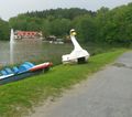
We took some pictures and left the place for a stop-over at the reservoir. We missed it in the first place, since it was much smaller than expected, but arrived later during heavy rain. After almost half an hour of waiting we left our mobile shelter and had a look around at the water's edge and saw that the lake is used primarily for pedal boats, but not today.
Photos
Achievements
AmicaNoctis earned the Land geohash achievement
|


