Difference between revisions of "2014-05-10 44 -123"
imported>Frogman (Created page with "{{subst:Expedition |lat = 44 |lon = -123 |date = 2014-05-10 }}") |
imported>FippeBot m (Location) |
||
| (7 intermediate revisions by one other user not shown) | |||
| Line 18: | Line 18: | ||
__NOTOC__ | __NOTOC__ | ||
== Location == | == Location == | ||
| − | + | On a forested hill east of Alsea, Oregon. | |
== Participants == | == Participants == | ||
| − | + | *[[User:Frogman|Frogman]] | |
| − | + | *Greg | |
| + | *Alison | ||
| + | *Marie | ||
== Plans == | == Plans == | ||
| − | + | It was a lazy Saturday and we hadn't hung out as a group in a while. The obvious remedy: geohashing! | |
== Expedition == | == Expedition == | ||
| − | + | The hashpoint was on a hill, and we wanted to drive as close as possible before hiking. The road on Google Maps didn't look very promising in person, so we decided to go up a nearby logging road. Bad idea! The road was steep, narrow, and had no turnarounds until very close to the top. It got us farther away from the hashpoint! At the top we finally came across a place to turn around. We scared away some vultures from the bones of an unidentified ungulate. The view was nice. | |
| + | |||
| + | After returning to the road suggested by Google Maps, we saw that not only was it better-kept than the logging road, but also it was public land. Score! We were able to get within about 100 meters of the hashpoint as the crow flies, but it was up an incredibly steep hill. We ended up taking a circuitous route before eventually honing in on the hashpoint. We grinned, stood around, debated net neutrality, and then left. | ||
== Tracklog == | == Tracklog == | ||
| Line 38: | Line 42: | ||
--> | --> | ||
<gallery perrow="5"> | <gallery perrow="5"> | ||
| + | Image:2014-05-10 44 -123 view1.jpg | View from the logging road. | ||
| + | Image:2014-05-10 44 -123 marie.jpg | Marie | ||
| + | Image:2014-05-10 44 -123 bones.jpg | There were bones in the road! | ||
| + | Image:2014-05-10 44 -123 hill.jpg | Here is a picture of another logging road. We tried to drive up it but the truck couldn't make it. | ||
| + | Image:2014-05-10 44 -123 look.jpg | Look over there! | ||
| + | Image:2014-05-10 44 -123 trash.jpg | There was some trash up here. Cottage cheese, etc. | ||
| + | Image:2014-05-10 44 -123 view2.jpg | Another view from the logging road. | ||
| + | Image:2014-05-10 44 -123 bug.jpg | A bug! | ||
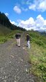
| + | Image:2014-05-10 44 -123 hike.jpg | We had to hike up a pretty steep hill. | ||
| + | Image:2014-05-10 44 -123 hashpoint.jpg | Here is the hashpoint! | ||
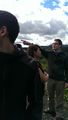
| + | Image:2014-05-10 44 -123 grins.jpg | Goofy grins! | ||
| + | Image:2014-05-10 44 -123 hashscot.jpg | I have a hashscot now. Here he is! | ||
| + | Image:2014-05-10 44 -123 hashscot head.jpg | Here he is on Alison's head! | ||
</gallery> | </gallery> | ||
| Line 44: | Line 61: | ||
<!-- Add any achievement ribbons you earned below, or remove this section --> | <!-- Add any achievement ribbons you earned below, or remove this section --> | ||
| − | |||
| − | |||
| − | |||
| − | |||
| − | |||
| − | |||
| − | |||
| − | |||
| − | |||
| − | |||
| − | |||
| − | |||
| − | |||
[[Category:Expeditions]] | [[Category:Expeditions]] | ||
| − | |||
[[Category:Expeditions with photos]] | [[Category:Expeditions with photos]] | ||
| − | |||
| − | |||
| − | |||
| − | |||
| − | |||
[[Category:Coordinates reached]] | [[Category:Coordinates reached]] | ||
| − | + | {{location|US|OR|BE}} | |
| − | |||
| − | |||
| − | |||
| − | |||
| − | |||
| − | |||
| − | |||
| − | |||
| − | |||
| − | |||
| − | |||
| − | |||
| − | |||
| − | |||
| − | |||
| − | |||
| − | |||
Latest revision as of 06:29, 14 August 2019
| Sat 10 May 2014 in 44,-123: 44.3946230, -123.5524217 geohashing.info google osm bing/os kml crox |
Location
On a forested hill east of Alsea, Oregon.
Participants
- Frogman
- Greg
- Alison
- Marie
Plans
It was a lazy Saturday and we hadn't hung out as a group in a while. The obvious remedy: geohashing!
Expedition
The hashpoint was on a hill, and we wanted to drive as close as possible before hiking. The road on Google Maps didn't look very promising in person, so we decided to go up a nearby logging road. Bad idea! The road was steep, narrow, and had no turnarounds until very close to the top. It got us farther away from the hashpoint! At the top we finally came across a place to turn around. We scared away some vultures from the bones of an unidentified ungulate. The view was nice.
After returning to the road suggested by Google Maps, we saw that not only was it better-kept than the logging road, but also it was public land. Score! We were able to get within about 100 meters of the hashpoint as the crow flies, but it was up an incredibly steep hill. We ended up taking a circuitous route before eventually honing in on the hashpoint. We grinned, stood around, debated net neutrality, and then left.
Tracklog
Photos
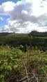
View from the logging road.
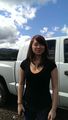
Marie
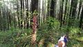
There were bones in the road!
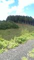
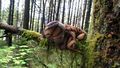
Here is a picture of another logging road. We tried to drive up it but the truck couldn't make it.
Look over there!
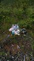
There was some trash up here. Cottage cheese, etc.
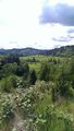
Another view from the logging road.
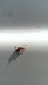
A bug!
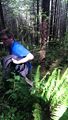
We had to hike up a pretty steep hill.
Here is the hashpoint!

Goofy grins!
I have a hashscot now. Here he is!
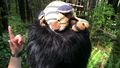
Here he is on Alison's head!


