Difference between revisions of "2014-05-18 50 8"
imported>Mampfred (Created page with "{{subst:Expedition |lat = 50 |lon = 8 |date = 2014-05-18 }}") |
imported>FippeBot m (Location) |
||
| (8 intermediate revisions by 2 users not shown) | |||
| Line 1: | Line 1: | ||
| − | |||
| − | |||
| − | |||
| − | |||
| − | |||
| − | |||
| − | |||
| − | |||
| − | |||
| − | |||
{{meetup graticule | {{meetup graticule | ||
| lat=50 | | lat=50 | ||
| Line 15: | Line 5: | ||
}} | }} | ||
| − | |||
__NOTOC__ | __NOTOC__ | ||
== Location == | == Location == | ||
| − | + | Outside Idstein. | |
== Participants == | == Participants == | ||
| − | + | * [[User:Mampfred|Mampfred]] | |
| − | + | * [[User:LadyBB|LadyBB]] | |
| + | * [[User:EmmJay|EmmJay]] | ||
| + | * [[User:GeorgDerReisende|GeorgDerReisende]] | ||
| + | * [[User:M|M]] | ||
| + | * [[User:QuarterCacher|QuarterCacher]] | ||
== Plans == | == Plans == | ||
| − | + | Totally around the corner. Can't not do it. Let us know if you're interested and we'll find a time for a meetup. | |
| + | |||
| + | === [[User:GeorgDerReisende|GeorgDerReisende]] === | ||
| + | |||
| + | Coming from [[2014-05-17 51 7]] I will spend the night to Sunday in the picnic shelter east of Idstein, the place is called ''Drei Eichen'' or ''Alter Badeweiher''. Because it's Sunday I will not start for geohashing before 10:00. I will be at the hash at about 11:00, from there it's a walk of 3.1 kilometers. | ||
| + | : Excellent! We just noticed that we have an appointment at 13:00 so we can only do it before lunch as well. Perfect timing. Just to clarify, you will be at the hash at 11:00 or you'll start walking the 3.1km at 11:00? I'll also PM you my mobile number just in case (if it's enabled). - [[User:Mampfred|Mampfred]] ([[User talk:Mampfred|talk]]) 02:16, 17 May 2014 (EDT) | ||
| + | :: I want to start at the shelter at 10:00 and I want to reach the hash at 11:00. --[[User:GeorgDerReisende|GeorgDerReisende]] ([[User talk:GeorgDerReisende|talk]]) 02:31, 17 May 2014 (EDT) | ||
| + | ::: Perfect see you there. I'll see if I can activate [[User:M|M]] and [[User:QuarterCacher|QuarterCacher]] as well. - [[User:Mampfred|Mampfred]] ([[User talk:Mampfred|talk]]) 02:49, 17 May 2014 (EDT) | ||
== Expedition == | == Expedition == | ||
| − | |||
| − | == | + | === [[User:GeorgDerReisende|GeorgDerReisende]] === |
| − | + | ||
| + | {| | ||
| + | |- | ||
| + | ! style="width:300px" | !! style="width:600px" | | ||
| + | |- | ||
| + | | [[Image:2014-05-18 50 8 GeorgDerReisende 0722.jpg|300px]] || Coming from the successful [[2014-05-17 51 7]] I hitchhiked from Haltern to Idstein with the help of five cars. At the service station Remscheid I had an uncommon short waiting time to get a car for the A3, but at the service station Siegburg I had to wait longer. The motorways were empty, because there was an important ''fußball'' game at the TV.<br>I arrived at the Idstein at 0:15 and walked through the village to that place I had chosen for the night. But instead of a shelter for hikers it was a closed barbecue hut. So I slept outside of it. The night was a bit cold. | ||
| + | |- | ||
| + | | [[Image:2014-05-18 50 8 GeorgDerReisende 0726.jpg|300px]] || In the morning I started to walk to the hash at 10:00. I passed under these trees looking very dangerous. | ||
| + | |- | ||
| + | | [[Image:2014-05-18 50 8 GeorgDerReisende 0743.jpg|300px]] || At 10:37 I found the hash. After some dancing my Garmin decided, that the hash lay on the way. Then I remembered, that I had an appointment and sat down and waited for them. | ||
| + | |- | ||
| + | | [[Image:2014-05-18 50 8 GeorgDerReisende 0745.jpg|300px]] || And they arrived some minutes later. I came to know [[User:M|M]] and [[User:QuarterCacher|QuarterCacher]]. | ||
| + | |- | ||
| + | | [[Image:2014-05-18 50 8 GeorgDerReisende 0748.jpg|300px]] || The group of all today's geohashers: [[User:M|M]], [[User:EmmJay|EmmJay]], [[User:QuarterCacher|QuarterCacher]], [[User:LadyBB|LadyBB]], [[User:Mampfred|Mampfred]] and [[User:GeorgDerReisende|GeorgDerReisende]]. | ||
| + | |- | ||
| + | | [[Image:2014-05-18 50 8 GeorgDerReisende 0749.jpg|300px]] || [[User:EmmJay|EmmJay]] liked to play games again, today blowing bubbles. | ||
| + | |- | ||
| + | | [[Image:2014-05-18 50 8 GeorgDerReisende 0750.jpg|300px]] || I wrote a mark onto a tree. | ||
| + | |- | ||
| + | | [[Image:2014-05-18 50 8 GeorgDerReisende 0754.jpg|300px]] || View to Idstein from outside the forest. | ||
| + | |- | ||
| + | | [[Image:2014-05-18 50 8 GeorgDerReisende 0779.jpg|300px]] || Usually my story ends here. But I have an addendum. I wanted to hitchhike from Idstein to the service station Wetterau along the national road B 275. And I started for it. After two short lifts I ended at the village Niederems. There I waited for two hours, but only tourists and motorcycles passed by. Then I got a lift, but mistakenly it went to Oberems, which was not my direction. At this moment, I didn't want to hitchhike or hike further and I decided to take a bus to the main village, to start to hitchhike there again. From that place I got a lift to the service station Rebstock near Frankfurt am Main and from there a lift to the service station Wetterau. Standing there at the exit and waiting for a car to Kassel a car stopped and the driver told me that he had taken me on a former expedition of geohashing! But today he didn't go to Kassel and I took another car. | ||
| + | |} | ||
| + | |||
| + | === The rest of the group === | ||
| + | We met up in Niederjosbach and drove past Idstein to the hash. We had plenty of time so we let EmmJay walk for a while which naturally slowed us down quite a bit. When we got there before 11am, we found GeorgDerReisende already sitting at the hash :) | ||
| + | |||
| + | We took some group shots and GeorgDerReisende wrote the hash marker on a tree. Then we walked back to the car together and split up knowing that it's probably not too long before we see each other at the next hash again. | ||
| + | |||
| + | We've got only one photo to add: | ||
| − | + | <gallery> | |
| − | < | + | Image:2014-05-18_50_8_GeorgDerReisende_writing_the_marker.jpg | GeorgDerReisende marking a tree. |
| − | Image: | ||
| − | |||
| − | |||
</gallery> | </gallery> | ||
| + | |||
| + | == Tracklog == | ||
| + | The tracklog of the car-crew from the parking to the hash can be found [http://www.everytrail.com/view_trip.php?trip_id=2785600 here]. | ||
== Achievements == | == Achievements == | ||
{{#vardefine:ribbonwidth|800px}} | {{#vardefine:ribbonwidth|800px}} | ||
<!-- Add any achievement ribbons you earned below, or remove this section --> | <!-- Add any achievement ribbons you earned below, or remove this section --> | ||
| + | {{Walk geohash | latitude = 50 | longitude = 8 | date = 2014-05-18 | name = GeorgDerReisende | distance = 2.3 km }} | ||
| − | |||
| − | |||
| − | |||
| − | |||
| − | |||
| − | |||
| − | |||
| − | |||
| − | |||
| − | |||
| − | |||
| − | |||
| − | |||
[[Category:Expeditions]] | [[Category:Expeditions]] | ||
| − | |||
[[Category:Expeditions with photos]] | [[Category:Expeditions with photos]] | ||
| − | |||
| − | |||
| − | |||
| − | |||
| − | |||
[[Category:Coordinates reached]] | [[Category:Coordinates reached]] | ||
| − | + | {{location|DE|HE|SWA}} | |
| − | |||
| − | |||
| − | |||
| − | |||
| − | |||
| − | |||
| − | |||
| − | |||
| − | |||
| − | |||
| − | |||
| − | |||
| − | |||
| − | |||
| − | |||
| − | |||
| − | |||
Latest revision as of 06:34, 14 August 2019
| Sun 18 May 2014 in 50,8: 50.2292828, 8.2952969 geohashing.info google osm bing/os kml crox |
Location
Outside Idstein.
Participants
Plans
Totally around the corner. Can't not do it. Let us know if you're interested and we'll find a time for a meetup.
GeorgDerReisende
Coming from 2014-05-17 51 7 I will spend the night to Sunday in the picnic shelter east of Idstein, the place is called Drei Eichen or Alter Badeweiher. Because it's Sunday I will not start for geohashing before 10:00. I will be at the hash at about 11:00, from there it's a walk of 3.1 kilometers.
- Excellent! We just noticed that we have an appointment at 13:00 so we can only do it before lunch as well. Perfect timing. Just to clarify, you will be at the hash at 11:00 or you'll start walking the 3.1km at 11:00? I'll also PM you my mobile number just in case (if it's enabled). - Mampfred (talk) 02:16, 17 May 2014 (EDT)
- I want to start at the shelter at 10:00 and I want to reach the hash at 11:00. --GeorgDerReisende (talk) 02:31, 17 May 2014 (EDT)
- Perfect see you there. I'll see if I can activate M and QuarterCacher as well. - Mampfred (talk) 02:49, 17 May 2014 (EDT)
- I want to start at the shelter at 10:00 and I want to reach the hash at 11:00. --GeorgDerReisende (talk) 02:31, 17 May 2014 (EDT)
Expedition
GeorgDerReisende
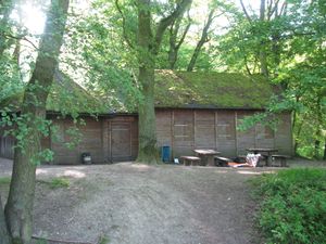 |
Coming from the successful 2014-05-17 51 7 I hitchhiked from Haltern to Idstein with the help of five cars. At the service station Remscheid I had an uncommon short waiting time to get a car for the A3, but at the service station Siegburg I had to wait longer. The motorways were empty, because there was an important fußball game at the TV. I arrived at the Idstein at 0:15 and walked through the village to that place I had chosen for the night. But instead of a shelter for hikers it was a closed barbecue hut. So I slept outside of it. The night was a bit cold. |
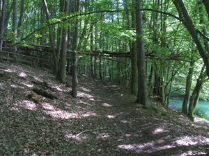 |
In the morning I started to walk to the hash at 10:00. I passed under these trees looking very dangerous. |
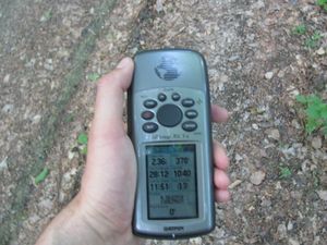 |
At 10:37 I found the hash. After some dancing my Garmin decided, that the hash lay on the way. Then I remembered, that I had an appointment and sat down and waited for them. |
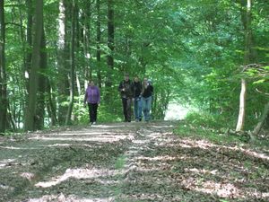 |
And they arrived some minutes later. I came to know M and QuarterCacher. |
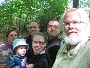 |
The group of all today's geohashers: M, EmmJay, QuarterCacher, LadyBB, Mampfred and GeorgDerReisende. |
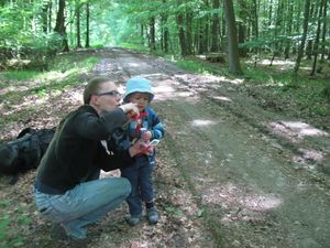 |
EmmJay liked to play games again, today blowing bubbles. |
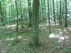 |
I wrote a mark onto a tree. |
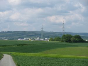 |
View to Idstein from outside the forest. |
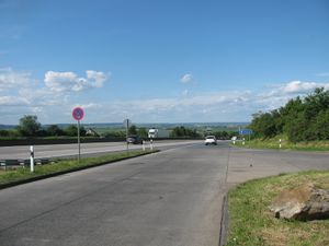 |
Usually my story ends here. But I have an addendum. I wanted to hitchhike from Idstein to the service station Wetterau along the national road B 275. And I started for it. After two short lifts I ended at the village Niederems. There I waited for two hours, but only tourists and motorcycles passed by. Then I got a lift, but mistakenly it went to Oberems, which was not my direction. At this moment, I didn't want to hitchhike or hike further and I decided to take a bus to the main village, to start to hitchhike there again. From that place I got a lift to the service station Rebstock near Frankfurt am Main and from there a lift to the service station Wetterau. Standing there at the exit and waiting for a car to Kassel a car stopped and the driver told me that he had taken me on a former expedition of geohashing! But today he didn't go to Kassel and I took another car. |
The rest of the group
We met up in Niederjosbach and drove past Idstein to the hash. We had plenty of time so we let EmmJay walk for a while which naturally slowed us down quite a bit. When we got there before 11am, we found GeorgDerReisende already sitting at the hash :)
We took some group shots and GeorgDerReisende wrote the hash marker on a tree. Then we walked back to the car together and split up knowing that it's probably not too long before we see each other at the next hash again.
We've got only one photo to add:
Tracklog
The tracklog of the car-crew from the parking to the hash can be found here.
Achievements
GeorgDerReisende earned the Walk geohash Achievement
|
