Difference between revisions of "2014-08-24 62 27"
imported>Tilley (Tilley&co in blueberry hashing.) |
imported>FippeBot m (Location) |
||
| Line 51: | Line 51: | ||
[[Category:Expeditions with photos]] | [[Category:Expeditions with photos]] | ||
[[Category:Coordinates reached]] | [[Category:Coordinates reached]] | ||
| + | {{location|FI|15}} | ||
Revision as of 01:08, 15 August 2019
| Sun 24 Aug 2014 in 62,27: 62.6193152, 27.0633142 geohashing.info google osm bing/os kml crox |
Location
In Multakangas, Suonenjoki. The point is in forest.
Participants
- Tilley
- Mrs. Tilley
- Tilley's daughter
Expedition
We we're planning to spend our Sunday visiting a summer camp that was held in Laukaa. The camp was for children from Russian orphanages and some of the organizers were our friends. Conveniently on the way there was a hashpoint in Suonenjoki.
After the breakfast we packed ourselves into our car and drove away. After half an hour of driving we already felt that it would be nice to stop for a little walk. The hash was situated a few kilometers outside the small town of Suonenjoki. It was in a near perfect location. We could leave our car right beside the main road, and from there also began a forest trail, that led almost directly to the hashpoint. Otherwise the area was quite swampy, but the hashpoint was in a small ridgeline acting as an "island", that rose from the middle of the swamp.
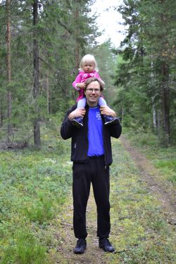
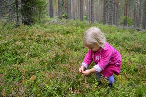
The GPS showed 650 meters to the point, when we started our walk. Immediately as we entered the treeline, we noted that there were a lot of blueberries and lingonberries. The lingonberries were not quite ripe yet, too bad. But the blueberries were still good. Once in a while stopping to pick them, we steadily advanced towards the hashpoint. The air was refreshingly moist, in other words, there was some slight rain. Quite soon our hashtoddler wanted a lift from daddy.
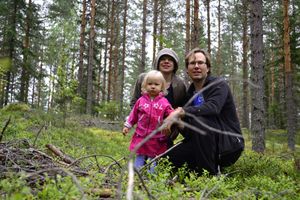
When there was 60 meters to the point, the arrow was pointing sideways, and we stepped out of the trail into the forest. There was even more and bigger blueberries here, and it was difficult to reach the point, when the hunter-forager instincts kicked on and forbade to walk past such a great source of food. When our stomachs started to be full of blueberries, we managed to find the point and to take some photographic evidence.
After a successful mission we walked back along an other trail (still eating some blueberries). A very refreshing forest walk. Wouldn't have known about this great blueberry place if it wasn't for the hashpoint.
Distance walked: 1,4 km. Extra distance driven by car to reach the hashpoint: 50 m.
Additional photos
Achievements
Tilley&co earned the Land geohash achievement
|


