Difference between revisions of "2014-10-05 49 8"
From Geohashing
imported>Tads (Created page with "{{subst:Expedition |lat = 49 |lon = 8 |date = 2014-10-05 }}") |
imported>Tads |
||
| Line 1: | Line 1: | ||
| − | |||
| − | |||
| − | |||
| − | |||
| − | |||
| − | |||
| − | |||
| − | |||
| − | |||
| − | |||
{{meetup graticule | {{meetup graticule | ||
| lat=49 | | lat=49 | ||
| Line 19: | Line 9: | ||
== Location == | == Location == | ||
<!-- where you've surveyed the hash to be --> | <!-- where you've surveyed the hash to be --> | ||
| + | Hashpoint is on a field close to Riedstadt-Leeheim. | ||
== Participants == | == Participants == | ||
<!-- who attended: If you link to your wiki user name in this section, your expedition will be picked up by the various statistics generated for geohashing. You may use three tildes ~ as a shortcut to automatically insert the user signature of the account you are editing with. | <!-- who attended: If you link to your wiki user name in this section, your expedition will be picked up by the various statistics generated for geohashing. You may use three tildes ~ as a shortcut to automatically insert the user signature of the account you are editing with. | ||
--> | --> | ||
| − | + | [[User:Tads|Tads]] ([[User talk:Tads|talk]]) | |
| − | |||
| − | |||
| − | |||
== Expedition == | == Expedition == | ||
<!-- how it all turned out. your narrative goes here. --> | <!-- how it all turned out. your narrative goes here. --> | ||
| + | [[User:Tads|tads]] went to the hashpoint on his bike. At the hashpoint he met some first-time geohasher (with handshake but anonymous). | ||
== Tracklog == | == Tracklog == | ||
<!-- if your GPS device keeps a log, you may post a link here --> | <!-- if your GPS device keeps a log, you may post a link here --> | ||
| + | [https://www.google.com/maps/d/viewer?mid=z4gnKDo1tzTs.k8ajHP2qDTgM Map of the trip] | ||
== Photos == | == Photos == | ||
| Line 38: | Line 28: | ||
--> | --> | ||
<gallery perrow="5"> | <gallery perrow="5"> | ||
| + | Image:2014-10-05_49_8_1.jpg | Me at the hashpoint. | ||
| + | Image:2014-10-05_49_8_2.jpg | View over the field on a nearby golf park. | ||
</gallery> | </gallery> | ||
| − | |||
| − | |||
| − | |||
| − | |||
<!-- =============== USEFUL CATEGORIES FOLLOW ================ | <!-- =============== USEFUL CATEGORIES FOLLOW ================ | ||
Delete the next line ONLY if you have chosen the appropriate categories below. If you are unsure, don't worry. People will read your report and help you with the classification.--> | Delete the next line ONLY if you have chosen the appropriate categories below. If you are unsure, don't worry. People will read your report and help you with the classification.--> | ||
| − | [[Category: | + | [[Category:Expeditions]] |
| + | [[Category:Coordinates reached]] | ||
| + | [[Category:Expeditions with photos]] | ||
<!-- ==REQUEST FOR TWITTER BOT== Please leave either the New report or the Expedition planning category in as long as you work on it. This helps the twitter bot a lot with announcing the right outcome at the right moment. --> | <!-- ==REQUEST FOR TWITTER BOT== Please leave either the New report or the Expedition planning category in as long as you work on it. This helps the twitter bot a lot with announcing the right outcome at the right moment. --> | ||
Revision as of 16:59, 5 October 2014
| Sun 5 Oct 2014 in 49,8: 49.8552437, 8.4615440 geohashing.info google osm bing/os kml crox |
Location
Hashpoint is on a field close to Riedstadt-Leeheim.
Participants
Expedition
tads went to the hashpoint on his bike. At the hashpoint he met some first-time geohasher (with handshake but anonymous).
Tracklog
Photos

Me at the hashpoint.
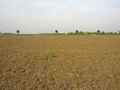
View over the field on a nearby golf park.

