Difference between revisions of "2014-10-25 51 13"
imported>Danatar (Report) |
imported>FippeBot m (Location) |
||
| Line 48: | Line 48: | ||
[[Category:Danatar]] | [[Category:Danatar]] | ||
[[Category:Tron achievement]] | [[Category:Tron achievement]] | ||
| + | {{location|DE|SN|DD}} | ||
Latest revision as of 01:49, 15 August 2019
| Sat 25 Oct 2014 in Dresden: 51.0818289, 13.7737192 geohashing.info google osm bing/os kml crox |
Location
Today's location is near the Prießnitz creek in the forest behind the Graf-Stauffenberg-Kaserne (barracks) in Dresden.
Country: Germany; state: Sachsen (Saxony, EU:DE:SN); district: Dresden; Ortsamt: Neustadt; statistischer Stadtteil: Albertstadt.
Weather: Sunny but fresh, around 12 °C
Planning
- Danatar: I will probably be there at 4 p.m.
Expedition
Danatar
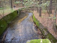
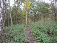
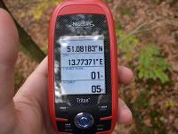
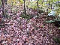
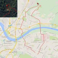
A Saturday hashpoint in Dresden, I have time to visit it, nice weather, great! Even though the spot was on the far side of "walking distance" I decided to visit it on foot, running. Shortly after 3 p.m. I started, running towards the city center before crossing the Elbe on the Albertbrücke bridge. The construction work there is still in full swing and I had to zig-zag a bit before I could run through the Äußere Neustadt city district to the Alaun park. From there I went along the street I knew from 2014-08-01 51 13 and took a look at that hashpoint, not leaving the path this time. On the other side of the Stauffenbergallee a tiny portion of the "Dresdner Heide" forest started and the track I was on went down- and uphill a bit. I crossed the Prießnitz creek, followed the track a little more, then I used a small trail that went towards the hashpoint. On the last part, after I left that trail, I was very careful not to walk into any natural dead ends because I wanted to do this expedition as a tron. Suddenly I was at the hashpoint, on the edge of a small depression where probably a small creek runs down during rain. By the time I had caught my breath (the hilly part in the forest was the most difficult to run and I even needed to walk for a bit) and took my pictures it was 16:05 but I hadn't seen any other people near the spot so I guess I didn't miss anybody. After a few minutes I continued past the hashpoint, then turned towards the Marienallee road that was nearby in the east. I had planned to run along Schützenweg, thus through the forest for a bit, but there were multiple tracks. In retrospect I was on the correct one, but then I left it at the north cemetery, walking along the cemetery's perimeter until I was back on the Marienallee. I followed that one past the barracks, then I ran along Stauffenbergallee and across the Waldschlösschenbrücke. By the time I ran through the university hospital compound and even more afterwards I was really tired, because not only was this longer than my usual running distance, I also hadn't been running since I was in New York a month ago.
|
