Difference between revisions of "2014-11-05 59 18"
From Geohashing
imported>Odberger ([live picture] Me in the woods south of Stockholm [http://www.openstreetmap.org/?lat=59.13873259&lon=18.03234451&zoom=16&layers=B000FTF @59.1387,18.0323]) |
imported>Odberger ([live picture] The sign [http://www.openstreetmap.org/?lat=59.13873298&lon=18.03235901&zoom=16&layers=B000FTF @59.1387,18.0324]) |
||
| Line 39: | Line 39: | ||
Image:2014-11-05_59_18_Odberger_1415186476945.jpg | Me in the woods south of Stockholm [http://www.openstreetmap.org/?lat=59.13873259&lon=18.03234451&zoom=16&layers=B000FTF @59.1387,18.0323] | Image:2014-11-05_59_18_Odberger_1415186476945.jpg | Me in the woods south of Stockholm [http://www.openstreetmap.org/?lat=59.13873259&lon=18.03234451&zoom=16&layers=B000FTF @59.1387,18.0323] | ||
| + | |||
| + | Image:2014-11-05_59_18_Odberger_1415186637498.jpg | The sign [http://www.openstreetmap.org/?lat=59.13873298&lon=18.03235901&zoom=16&layers=B000FTF @59.1387,18.0324] | ||
</gallery> | </gallery> | ||
Revision as of 11:22, 5 November 2014
| Wed 5 Nov 2014 in 59,18: 59.1387225, 18.0323577 geohashing.info google osm bing/os kml crox |
Location
Tungelsta, a southern suburb to Stockholm, Sweden
Participants
Plans
This will be my fourth hash ever, and third hashing day in a row. I'll take a long lunch break and go there by car and will walk the last kilometer as it seems like you're not allowed driving on the nearest road. Will unfortunately not be able to be there at 16:00.
Expedition
BBL
Tracklog
Photos
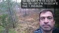
Me in the woods south of Stockholm @59.1387,18.0323
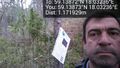
The sign @59.1387,18.0324

