Difference between revisions of "2014-11-12 49 8"
From Geohashing
imported>RecentlyChanged (An expedition message sent via Geohash Droid for Android.) |
imported>FippeBot m (Location) |
||
| (4 intermediate revisions by 2 users not shown) | |||
| Line 15: | Line 15: | ||
}} | }} | ||
| − | + | ||
__NOTOC__ | __NOTOC__ | ||
== Location == | == Location == | ||
| − | + | Somewhere in Germany | |
== Participants == | == Participants == | ||
| − | + | ||
| − | + | * [[User:RecentlyChanged|RecentlyChanged]] | |
| + | * [[User:deuded|deuded]] | ||
== Plans == | == Plans == | ||
<!-- what were the original plans --> | <!-- what were the original plans --> | ||
| + | |||
| + | Unknown | ||
== Expedition == | == Expedition == | ||
<!-- how it all turned out. your narrative goes here. --> | <!-- how it all turned out. your narrative goes here. --> | ||
| + | |||
| + | Looks like they made it. (Thanks for that edit - [[User:RecentlyChanged|RC]]) | ||
| + | |||
| + | Yes, we made it. We went in the evening (at about 8 pm), we took the tram and tried to walk to the hash without looking up the coordinates, but because we didn't prepare us we failed miserably at this task. | ||
| + | We had a beer with the hashpoint, but the weather wasn't really well, so we quickly decided to go back home. | ||
== Tracklog == | == Tracklog == | ||
| Line 34: | Line 42: | ||
== Photos == | == Photos == | ||
| − | + | ||
| − | |||
| − | |||
<gallery perrow="5"> | <gallery perrow="5"> | ||
| + | Image:2014-11-12_49_8_RecentlyChanged_1415819672000.jpg | Happy Deuded :) [http://www.openstreetmap.org/?lat=49.01096463&lon=8.49165916&zoom=16&layers=B000FTF @49.0110,8.4917] | ||
</gallery> | </gallery> | ||
== Achievements == | == Achievements == | ||
{{#vardefine:ribbonwidth|800px}} | {{#vardefine:ribbonwidth|800px}} | ||
| − | |||
| + | * Land Geohash | ||
| − | |||
| − | |||
| − | |||
| − | |||
| − | + | [[Category:Expeditions]] | |
| − | |||
| − | [[Category: | ||
| − | |||
| − | |||
| − | |||
| − | |||
[[Category:Expeditions with photos]] | [[Category:Expeditions with photos]] | ||
| − | |||
| − | |||
| − | |||
| − | |||
| − | |||
[[Category:Coordinates reached]] | [[Category:Coordinates reached]] | ||
| − | + | {{location|DE|BW|KA|city=true}} | |
| − | |||
| − | |||
| − | |||
| − | |||
| − | |||
| − | |||
| − | |||
| − | |||
| − | |||
| − | |||
| − | |||
| − | |||
| − | |||
| − | |||
| − | |||
| − | |||
| − | |||
Latest revision as of 01:57, 15 August 2019
| Wed 12 Nov 2014 in 49,8: 49.0108316, 8.4917740 geohashing.info google osm bing/os kml crox |
Location
Somewhere in Germany
Participants
Plans
Unknown
Expedition
Looks like they made it. (Thanks for that edit - RC)
Yes, we made it. We went in the evening (at about 8 pm), we took the tram and tried to walk to the hash without looking up the coordinates, but because we didn't prepare us we failed miserably at this task. We had a beer with the hashpoint, but the weather wasn't really well, so we quickly decided to go back home.
Tracklog
Photos
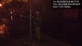
Happy Deuded :) @49.0110,8.4917

Achievements
- Land Geohash