Difference between revisions of "2015-01-14 59 17"
imported>Odberger (Created page with " <!-- If you did not specify these parameters in the template, please substitute appropriate values for IMAGE, LAT, LON, and DATE (YYYY-MM-DD format) Image:{{{image|IMAGE}...") |
imported>FippeBot m (Location) |
||
| (7 intermediate revisions by 2 users not shown) | |||
| Line 18: | Line 18: | ||
__NOTOC__ | __NOTOC__ | ||
== Location == | == Location == | ||
| − | + | Sollentuna, Stockholm, Sweden | |
== Participants == | == Participants == | ||
| Line 27: | Line 27: | ||
== Expedition == | == Expedition == | ||
| − | + | I parked about 400m from GZ and started to walk around a couple of houses and one small "mountain". It was harder than I thought as there was snow and it was slippery. I started with the Geocache and after logging that I was going to the Geohash. Allthough, I had missread the info. It was only 22m away from where I was standing! Score! So I walked over to the GZ which was a bit risky as it was on the edge over a 5-6m steep and with the snow it was hard to see the exact "break point". I walked as close as I dared and luckily it was right on the spot. I took the (crappy, uppside down) picture in the dark with a skiing hill in the background. I put up the poster and walked back to the car. | |
== Tracklog == | == Tracklog == | ||
| Line 38: | Line 38: | ||
<gallery perrow="5"> | <gallery perrow="5"> | ||
| + | |||
| + | Image:2015-01-14_59_17_Odberger_1421255638554.jpg | Me and a skiing hill in the background [http://www.openstreetmap.org/?lat=59.45835864&lon=17.96550092&zoom=16&layers=B000FTF @59.4584,17.9655] | ||
</gallery> | </gallery> | ||
| Line 45: | Line 47: | ||
| − | + | [[Category:Expeditions]] | |
| − | + | [[Category:Expeditions with photos]] | |
| − | [[Category: | + | [[Category:Coordinates reached]] |
| − | + | {{location|SE|AB}} | |
| − | |||
| − | |||
| − | |||
| − | |||
| − | |||
| − | |||
| − | |||
| − | [[Category: | ||
Latest revision as of 02:25, 15 August 2019
| Wed 14 Jan 2015 in 59,17: 59.4583621, 17.9654828 geohashing.info google osm bing/os kml crox |
Location
Sollentuna, Stockholm, Sweden
Participants
Plans
Todays Hash is located in Upplands Väsby which is a suburb north of Stockholm, Sweden. My plan is to go here after work (around 18:30) and put up the official poster. Pictures might be somewhat dark as the sun will be long gone by then. I will also log the nearby (200m) Geocache "Nummer två" which is one of the few in that neighborhood that I haven't logged yet.
Expedition
I parked about 400m from GZ and started to walk around a couple of houses and one small "mountain". It was harder than I thought as there was snow and it was slippery. I started with the Geocache and after logging that I was going to the Geohash. Allthough, I had missread the info. It was only 22m away from where I was standing! Score! So I walked over to the GZ which was a bit risky as it was on the edge over a 5-6m steep and with the snow it was hard to see the exact "break point". I walked as close as I dared and luckily it was right on the spot. I took the (crappy, uppside down) picture in the dark with a skiing hill in the background. I put up the poster and walked back to the car.
Tracklog
Photos
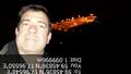
Me and a skiing hill in the background @59.4584,17.9655
