Difference between revisions of "2015-01-18 49 9"
From Geohashing
imported>Q-Owl (Created page with "<!-- marked Hashpoint|thumb|left -->{{meetup graticule | lat=49 | lon=9 | date=2015-01-18 }}__NOTOC__ == Location == Near wik...") |
imported>FippeBot m (Location) |
||
| (11 intermediate revisions by one other user not shown) | |||
| Line 1: | Line 1: | ||
| − | + | [[Image:2015-01-18 49 9 cool1.jpg|quite could today|thumb|left | |
| − | ]] | + | ]]{{meetup graticule |
| lat=49 | | lat=49 | ||
| lon=9 | | lon=9 | ||
| Line 6: | Line 6: | ||
== Location == | == Location == | ||
| − | + | In a little valley near [[wikipedia:Neuenstadt_am_Kocher|Neuenstadt am Kocher]]. | |
| − | == Participants == | + | == Participants == |
*[[User:Q-Owl|Q-Owl]] | *[[User:Q-Owl|Q-Owl]] | ||
| + | *[[User:Q-Owla|Q-Owla]] | ||
== Plan == | == Plan == | ||
| − | We | + | We like to visit this hashpoint during a little detour during a tour to [[wikipedia:Stuttgart|Stuttgart]]. <br>The hp lies near [[wikipedia:Neuenstadt_am_Kocher|Neuenstadt am Kocher]] in the [[wikipedia:Baden-Württemberg|Baden-Württemberg]] of the [[Würzburg,_Germany|Würzburg]] graticule. |
| − | + | ||
| − | We | + | We plan: |
| − | * | + | * drive near the hash point and walk up a nice little brook valley |
| − | * reach the hash point | + | * reach the hash point |
| − | * find | + | * find the geocache nearby |
| − | * | + | * continue the tour to Stuttgart |
== Expedition == | == Expedition == | ||
| − | + | Success: | |
| − | * We arrived | + | * It was really cold today - below zero. |
| − | * After a little bit of trying to find the best position under clouds and lage trees I | + | * We arrived about 11:00 near the hash point |
| − | * Then we walked back to the car and drove | + | * Then we had a <span style="text-decoration: line-through;">nice</span> very wet 1.6 km walk along a little brook valley to it. |
| + | * short before the hashpoint a swampy meadow | ||
| + | * After a little bit of trying to find the best position under clouds and lage trees, I took some photos. | ||
| + | * Then we walked back to the car and drove to Stuttgart. | ||
Results: | Results: | ||
* one geohash | * one geohash | ||
| − | * | + | * no geocache here ([http://coord.info/GC1878E GC1878E] not found) |
| − | * | + | * On our way back to the car we found and picked some big [http://en.wikipedia.org/wiki/Auricularia_auricula-judae jelly ears]. Nice for our next Chinese soup. |
| − | + | *I visited the degree confluence N 49° 00,000' E 9° 00,000' ([http://coord.info/GC438 GC438]) | |
== Photos == | == Photos == | ||
| + | |||
| + | <gallery perrow="5" > | ||
| + | Image:2015-01-18 49 9 cool1.jpg | quite could today | ||
| + | Image:2015-01-18 49 9 cool2.jpg | below zero near the cache | ||
| + | Image:2015-01-18 49 9 proof1.png | Proof | ||
| + | |||
| + | Image:2015-01-18 49 9 hp.jpg | Hashpoint next to the meadow and view to the west | ||
| + | Image:2015-01-18 49 9 n.jpg | view north | ||
| + | Image:2015-01-18 49 9 s.jpg | view south | ||
| + | Image:2015-01-18 49 9 grin.jpg | Smile | ||
| + | </gallery> | ||
<!-- | <!-- | ||
| − | + | Image:2015-01-18 49 9 wood.jpg | into the woods | |
| − | Image:2015-01- | + | --> |
| − | |||
| − | |||
| − | |||
| − | |||
| − | |||
| − | |||
<!-- | <!-- | ||
List of uploaded Files: | List of uploaded Files: | ||
| Line 53: | Line 62: | ||
== Achievements == <!-- / Honorable Mention --> | == Achievements == <!-- / Honorable Mention --> | ||
| − | + | ||
{{#vardefine:ribbonwidth|600px}} | {{#vardefine:ribbonwidth|600px}} | ||
{{land geohash | {{land geohash | ||
| Line 60: | Line 69: | ||
| date = 2015-01-18 | | date = 2015-01-18 | ||
| name = [[User:Q-Owl|Q-Owl]] | | name = [[User:Q-Owl|Q-Owl]] | ||
| − | }} -- | + | }} |
| − | + | {{Frozen Geohash | |
| + | | latitude = 49 | ||
| + | | longitude = 9 | ||
| + | | date = 2015-01-18 | ||
| + | | temperature = -1 °C | ||
| + | | name = [[User:Q-Owl|Q-Owl]] | ||
| + | | image = 2015-01-18 49 9 cool1.jpg | ||
| + | }} | ||
| + | |||
<!-- =============== USEFUL CATEGORIES FOLLOW ================ --> | <!-- =============== USEFUL CATEGORIES FOLLOW ================ --> | ||
<!-- Potential categories. Please include all the ones appropriate to your expedition | <!-- Potential categories. Please include all the ones appropriate to your expedition | ||
| Line 78: | Line 95: | ||
[[Category: Meetup on 2015-01-18]] | [[Category: Meetup on 2015-01-18]] | ||
[[Category: Meetup in 49 9]] | [[Category: Meetup in 49 9]] | ||
| + | {{location|DE|BW|HN}} | ||
Latest revision as of 02:27, 15 August 2019

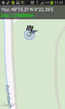
| Sun 18 Jan 2015 in 49,9: 49.2551586, 9.3731073 geohashing.info google osm bing/os kml crox |
Location
In a little valley near Neuenstadt am Kocher.
Participants
Plan
We like to visit this hashpoint during a little detour during a tour to Stuttgart.
The hp lies near Neuenstadt am Kocher in the Baden-Württemberg of the Würzburg graticule.
We plan:
- drive near the hash point and walk up a nice little brook valley
- reach the hash point
- find the geocache nearby
- continue the tour to Stuttgart
Expedition
Success:
- It was really cold today - below zero.
- We arrived about 11:00 near the hash point
- Then we had a nice very wet 1.6 km walk along a little brook valley to it.
- short before the hashpoint a swampy meadow
- After a little bit of trying to find the best position under clouds and lage trees, I took some photos.
- Then we walked back to the car and drove to Stuttgart.
Results:
- one geohash
- no geocache here (GC1878E not found)
- On our way back to the car we found and picked some big jelly ears. Nice for our next Chinese soup.
- I visited the degree confluence N 49° 00,000' E 9° 00,000' (GC438)
Photos

quite could today

below zero near the cache
Proof

Hashpoint next to the meadow and view to the west

view north

view south

Smile


Achievements
Q-Owl earned the Land geohash achievement
|
Q-Owl earned the Frozen Geohash Achievement
|