Difference between revisions of "2015-07-01 30 -81"
imported>DrCanadianNinja (Created page with "{{Advert}} {{meetup graticule | map=<map lat="30" lon="-81" date="2015-07-01" /> | lat=30 | lon=-81 | date=2015-07-01 | graticule_name=Jacksonville, Florida | graticule_link=...") |
imported>DrCanadianNinja (→Gallery: Finally got around to it...) |
||
| Line 36: | Line 36: | ||
== Gallery == | == Gallery == | ||
| − | + | <gallery caption="Photo Gallery" widths="200px" heights="200px" perrow="4"> | |
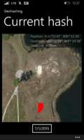
| + | Image:2015-07-01_30_-81_GPS.png|Success! | ||
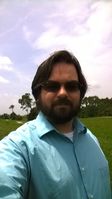
| + | Image:2015-07-01_30_-81_Geohasher.jpg| | ||
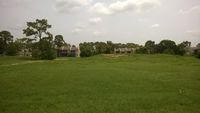
| + | Image:2015-07-01_30_-81_Geohash1.jpg| | ||
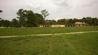
| + | Image:2015-07-01_30_-81_Geohash2.jpg| | ||
| + | Image:2015-07-01_30_-81_Geohash3.jpg| | ||
| + | Image:2015-07-01_30_-81_Geohash4.jpg| | ||
| + | Image:2015-07-01_30_-81_Marker.jpg|A♣ | ||
| + | Image:2015-07-01_30_-81_MarkerLocation.jpg|The rock it sat on. | ||
| + | </gallery> | ||
[[Category:Expeditions]] | [[Category:Expeditions]] | ||
[[Category:Coordinates reached]] | [[Category:Coordinates reached]] | ||
[[Category:Expeditions with photos]] | [[Category:Expeditions with photos]] | ||
Revision as of 13:09, 22 August 2015
| Have you seen our geohashing marker? We'd love to hear from you! Click here to say "hi" and tell us what you've seen!
Curious about what geohashing is? Read more! |
| Wed 1 Jul 2015 in Jacksonville, Florida: 30.2274850, -81.5599648 geohashing.info google osm bing/os kml crox |
Expedition
The Plan
On the closed Baymeadows Golf Club, off Baymeadows Circle.
The Geohashers
The Adventure
Six months without a doable geohash, then one pops up within a half mile of our house. Erica was sick, so I trekked out myself. I vaguely considered the Tron or Juggernaut achievements, as they were certainly possible, but it involved crossing several backyards of people I've never seen before; I'd rather not press my luck.
I'd like to quote a geohash from three years ago, when I briefly considered walking to a geohash three miles away: "Thankfully, sane minds prevailed on this one, noting that Palm Harbor is a terrible place to be out walking in the Florida heat at 1 PM with little shade and no breeze." Turns out that applies to Jacksonville, as I decided to walk to the hash, with a bit more shade but still no breeze.
Getting there wasn't the worst of it. It was once I got within range that the shade ran out and I was in the Florida heat at high noon. In addition, the app that I was using does not like being offroads. Despite doing the hash dance, it wanted to place me much further away. Even more puzzling, it was right on me while I was walking on the road. I'm not sure if it's the app or my phone that doesn't like offroad, but I should start bringing the driving GPS instead.
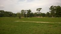
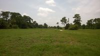
It wasn't much to see one way or another. The golf club has been closed for the last 10 years; the land was bought for development, but said development was vetoed due to infrastructure concerns, mainly putting more traffic on an already overflowing road. Because of this, it's been overgrown and barely maintained, so if you'd like to see what that looks like, uh, score? I left the Ace of Clubs on a nearby rock that likely doubles as a bench and sweated my way back home.
Achievables
Geoff earned the Walk geohash Achievement
|
Gallery
- Photo Gallery
