Difference between revisions of "2015-11-05 62 25"
imported>Tilley |
imported>Jiml m (Fix Grat) |
||
| Line 43: | Line 43: | ||
{{#vardefine:ribbonwidth|800px}} | {{#vardefine:ribbonwidth|800px}} | ||
| − | {{land geohash | latitude = 62 | longitude = | + | {{land geohash | latitude = 62 | longitude = 25 | date = 2015-11-05 | name = Tilley | image = 2015-11-05_62_24_selfie_kollaasi.JPG |
}} | }} | ||
| − | + | ||
| − | |||
[[Category:Expeditions]] | [[Category:Expeditions]] | ||
[[Category:Expeditions with photos]] | [[Category:Expeditions with photos]] | ||
[[Category:Coordinates reached]] | [[Category:Coordinates reached]] | ||
Revision as of 04:54, 6 November 2015
| Thu 5 Nov 2015 in 62,25: 62.1853320, 25.1377582 geohashing.info google osm bing/os kml crox |
Location
In Kukkaro, Petäjävesi. The point lies in the forest.
Participants
Expedition
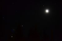
There was a chance to get this hashpoint along my journey to work, with only 9 km of detour. So I woke up at 4:30, 20 minutes earlier than usual, quickly dressed and took along my pre-packed stuff. It was a beautiful clear, starlit sky outside, the Moonsickle, Venus and Jupiter showing beautifully, but I had no time to admire the stars now. Soon I was racing along the small gravel roads in perfect darkness. Some of the roads were familiar, including the one that constitutes the Urria Special Stage in The Thousand Lakes WRC-Rally, but there was a few kilometers stretch of unknown territory.
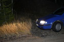
I had marked a couple of intersections to my GPS, because the route was quite twisty. The navigation went perfect, and I was soon, precisely 5:00, at the intersection of a small track, that, according to map, went to a field, beyond which the hashpoint lied. I turned into it, but after 20 meters realized that it was slower to drive on it than to run, and definitely slower to back up, if there wasn't any place to turn in the end. The hashpoint was only 450 meters away, so it was feasible to reach it by foot. So I backed up to the "main" road and left the car there running. This maneuvering had cost me 2 minutes, so I grabbed my camera and flashlight and left the car in a hurry.
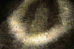
I jogged along the track, and after 100 meters encountered a couple of ropes serving as a fence! So the field wasn't an ordinary field, it was a pasture! So leaving the car behind was a good call. What wasn't a good call was forgetting to but my rubber boots on when leaving car. I had specifically taken them along, but was apparently in a too much of a hurry to remember to wear them. Well, so far so good. I followed a track in the side of the pasture, but then the GPS arrow pointing towards the hashpoint started to veer into the side so much, I had to go across the pasture. Dodging piles of cow droppings, I stumbled ahead. In the center of the pasture the moisture-content of the ground increased, but not so much it would wet my feet because the surface was a bit frosty. A couple of times I wondered, if there were any (angry/sleeping) cows in the pasture, that would soon come within the range of my flashlight. Then I reasoned, that it was November and cows would probably be in a shelter by now. (Later, when writing this report, I realized that there was a real possibility that they would have been highland cattle, in which case they would be outside all year long. So it was nice I didn't run into anything.)
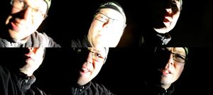
Ok, I had reached the other end of the pasture, so I crossed the fence, jumped over a ditch and was in a forest. A pretty thick one, too, and with a few big trees felled by the wind, laying on the ground. Only 80 meters to go, which in a Finnish forest can't be impossible in any case. Soon I was at the hashpoint, which was a bit clearer spot. Took some pictures, none of which were very successful. I believe they constitute the necessary proof, however, and that is what counts. I quickly turned back, and reached the pasture again almost in no time.
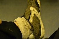
Navigating through the pasture the route I came was impossible in the darkness (I should get a better flashlight, or a better still, a headlight), and in some point I veered too much to the right. There was a spot that was still wetter, to the point I stepped in a couple of puddles and got my shoes all soaked and muddy. Great. This was exactly the reason I had the rubber boots.. The shoes were basically ruined, but I was thinking of getting new anyway, the soles are also almost worn out.
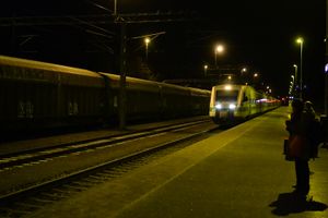
Well, no time to mourn the losses, gotta keep moving, time's a wasting. So I ran along the side of the meadow, then on the track back to the car. The time was 5:15. So it was time to put the pedal to the metal to make it to the train to Helsinki from the Jämsä station at 5:54. Actually, it wasn't even close, I arrived at the station 5:45 and only had to dodge one rabbit on the way. In the train I was even able to write this report and process the images (And why, oh why, Paint replaces the .jpg ending with .JPG when saving an image?!?!). So, very nice brisk expedition to start the day!
[Note: The image names all show a wrong graticule, since I was automatically thinking I was in 62, 24 graticule, when I was in fact at 62, 25. But I don't have the time to change them now. Or ever.]
Additional photos
Achievements
Tilley earned the Land geohash achievement
|
