Difference between revisions of "2015-12-17 42 -85"
From Geohashing
imported>Mcbaneg (Created page with "<!-- If you did not specify these parameters in the template, please substitute appropriate values for IMAGE, LAT, LON, and DATE (YYYY-MM-DD format) {{{image|dummy.jpg}}}|...") |
imported>FippeBot m (Location) |
||
| Line 51: | Line 51: | ||
[[Category:Expeditions with photos]] | [[Category:Expeditions with photos]] | ||
[[Category:Coordinates reached]] | [[Category:Coordinates reached]] | ||
| + | {{location|US|MI|KN}} | ||
Latest revision as of 06:10, 15 August 2019
| Thu 17 Dec 2015 in 42,-85: 42.8200273, -85.6973881 geohashing.info google osm bing/os kml crox |
Location
Next to a public path, Byron Center, MI
Participants
Expedition
The hashpoint was just south of town, in a narrow buffer area of woods between a paved path and an area being cleared for a new house. I took a detour on the way home from work, parked at the cemetery at the north end of the path, walked about 300m down the path, and reached the hashpoint without problems. I had hoped to arrive early enough for daylight photos but it was too dark for my cheap phone-camera to get decent ones.
Photos
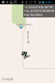
Parked at south end of cemetery.
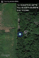
Closest approach of path to hashpoint (no green numbers here)
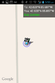
Proof.
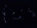
Christmas lights in someone's backyard adjacent to the walking path.


