Difference between revisions of "2015-12-28 -37 147"
From Geohashing
imported>Felix Dance ([live picture]Dinner Plain [http://www.openstreetmap.org/?lat=-37.01622110&lon=147.22556690&zoom=16&layers=B000FTF @-37.0162,147.2256]) |
imported>Felix Dance (added expedition) |
||
| Line 1: | Line 1: | ||
| + | [[Image:{{{image|Geohash 2015-12-28 -37 147 03 Group.JPG }}}|thumb|150px|left]] | ||
| − | |||
| − | |||
| − | |||
| − | |||
| − | |||
| − | |||
| − | |||
| − | |||
| − | |||
{{meetup graticule | {{meetup graticule | ||
| lat=-37 | | lat=-37 | ||
| Line 19: | Line 11: | ||
== Location == | == Location == | ||
| − | + | Off a walking track near Dinner Plain, adjacent to Mount Hotham, in the Victorian Alps. | |
== Participants == | == Participants == | ||
| − | + | *[[User:Felix Dance|Felix Dance]] | |
| − | + | *[[User:Stevage|Stevage]] | |
| − | + | *[[User:Lachie|Lachie]] | |
| − | + | *Rhonda | |
| − | + | *Matt | |
== Expedition == | == Expedition == | ||
| − | + | [https://goo.gl/maps/Fyqcj4nX6WH2 Here] is the route of our trip. | |
| − | |||
| − | |||
| − | |||
== Photos == | == Photos == | ||
| − | |||
| − | |||
| − | |||
<gallery perrow="5"> | <gallery perrow="5"> | ||
| − | |||
Image:2015-12-28_-37_147_Felix Dance_1451278289989.jpg|Dinner Plain [http://www.openstreetmap.org/?lat=-37.01622110&lon=147.22556690&zoom=16&layers=B000FTF @-37.0162,147.2256] | Image:2015-12-28_-37_147_Felix Dance_1451278289989.jpg|Dinner Plain [http://www.openstreetmap.org/?lat=-37.01622110&lon=147.22556690&zoom=16&layers=B000FTF @-37.0162,147.2256] | ||
| + | Image:Geohash 2015-12-28 -37 147 01 Walking.JPG|Matt and Lachie walking towards the hash | ||
| + | Image:Geohash 2015-12-28 -37 147 02 GPS.JPG|GPS Proof | ||
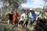
| + | Image:Geohash 2015-12-28 -37 147 03 Group.JPG|At the hash! | ||
| + | Image:Geohash 2015-12-28 -37 147 04 Hash.JPG|Lachie and Stevage discuss geohashing | ||
| + | Image:Geohash 2015-12-28 -37 147 05 Back.JPG|Heading back up the hill | ||
| + | Image:Geohash 2015-12-28 -37 147 06 Rest.JPG|Bench resting | ||
| + | Image:Geohash 2015-12-28 -37 147 07 View.JPG|The view near the hash | ||
| + | Image:Geohash 2015-12-28 -37 147 08 Road.JPG|The road forward | ||
</gallery> | </gallery> | ||
== Achievements == | == Achievements == | ||
| − | {{ | + | {{bicycle geohash |
| − | + | | latitude = -37 | |
| − | + | | longitude = 137 | |
| − | + | | date = 2015-12-28 | |
| − | + | | name = [[User:Felix Dance|Felix Dance]], [[User:Stevage|Stevage]], [[User:Lachie|Lachie]], Matt and Rhonda | |
| − | [[ | + | | distance = 85 kms |
| − | + | | bothways = TRUE | |
| − | + | | image = Geohash 2015-12-28 -37 147 03 Group.JPG | |
| − | + | }} | |
| − | [[ | ||
| − | |||
| − | |||
| − | |||
| − | |||
| − | |||
| − | |||
[[Category:Expeditions with photos]] | [[Category:Expeditions with photos]] | ||
| − | |||
| − | |||
| − | |||
| − | |||
| − | |||
[[Category:Coordinates reached]] | [[Category:Coordinates reached]] | ||
| − | |||
| − | |||
| − | |||
| − | |||
| − | |||
| − | |||
| − | |||
| − | |||
| − | |||
| − | |||
| − | |||
| − | |||
| − | |||
| − | |||
| − | |||
| − | |||
| − | |||
| − | |||
Revision as of 10:06, 2 January 2016
| Mon 28 Dec 2015 in -37,147: -37.0158495, 147.2259183 geohashing.info google osm bing/os kml crox |
Location
Off a walking track near Dinner Plain, adjacent to Mount Hotham, in the Victorian Alps.
Participants
- Felix Dance
- Stevage
- Lachie
- Rhonda
- Matt
Expedition
Here is the route of our trip.
Photos
Dinner Plain @-37.0162,147.2256
Achievements
Felix Dance, Stevage, Lachie, Matt and Rhonda earned the Bicycle geohash achievement
|


