Difference between revisions of "2016-01-21 62 21"
From Geohashing
imported>Thestormer ([live] Sucess) |
imported>FippeBot m (Location) |
||
| (7 intermediate revisions by 2 users not shown) | |||
| Line 20: | Line 20: | ||
== Location == | == Location == | ||
<!-- where you've surveyed the hash to be --> | <!-- where you've surveyed the hash to be --> | ||
| + | A cow field in Närpes next to route 67. | ||
== Participants == | == Participants == | ||
<!-- who attended: If you link to your wiki user name in this section, your expedition will be picked up by the various statistics generated for geohashing. You may use three tildes ~ as a shortcut to automatically insert the user signature of the account you are editing with. | <!-- who attended: If you link to your wiki user name in this section, your expedition will be picked up by the various statistics generated for geohashing. You may use three tildes ~ as a shortcut to automatically insert the user signature of the account you are editing with. | ||
--> | --> | ||
| + | [[User:Thestormer|thestormer]] ([[User talk:Thestormer|talk]]) | ||
== Plans == | == Plans == | ||
<!-- what were the original plans --> | <!-- what were the original plans --> | ||
| + | I downloaded the Geohash Droid to my phone today, so I wanted to test it. | ||
== Expedition == | == Expedition == | ||
<!-- how it all turned out. your narrative goes here. --> | <!-- how it all turned out. your narrative goes here. --> | ||
| + | It was -20 degrees when I headed out, luckily the coordinates weren't very far from the road, so I didn't have to be very long outside of the car. I did manage to get my hands quite cold though, since I dropped my GPS in the snow couple times, and didn't use any gloves. And a good thing it was winter and cold, because in summer there would be cows running around here! I reached the coordinates at 17:17. | ||
| − | |||
| − | |||
| − | |||
== Tracklog == | == Tracklog == | ||
<!-- if your GPS device keeps a log, you may post a link here --> | <!-- if your GPS device keeps a log, you may post a link here --> | ||
| Line 43: | Line 44: | ||
--> | --> | ||
<gallery perrow="5"> | <gallery perrow="5"> | ||
| + | Image:2016-21-01-62-21-success.png | The expedition was a success | ||
| + | Image:2016-21-01-62-21-internet.jpg | Sign posted on the electric fence | ||
</gallery> | </gallery> | ||
| Line 48: | Line 51: | ||
{{#vardefine:ribbonwidth|800px}} | {{#vardefine:ribbonwidth|800px}} | ||
<!-- Add any achievement ribbons you earned below, or remove this section --> | <!-- Add any achievement ribbons you earned below, or remove this section --> | ||
| + | {{land geohash | latitude = 62 | longitude = 21 | date = 2016-01-21 | name = [[User:thestormer|thestormer]]}} | ||
| − | + | {{Frozen Geohash | |
| − | + | | latitude = 62 | |
| − | [[ | + | | longitude = 21 |
| + | | date = 2016-01-21 | ||
| + | | temperature = -20°C | ||
| + | | name = [[User:thestormer|thestormer]] | ||
| + | | image = 2016-21-01-62-21-weather.png | ||
| + | }} | ||
| − | + | [[Category:Expeditions]] | |
| − | |||
| − | [[Category: | ||
| − | |||
| − | + | [[Category:Expeditions with photos]] | |
| − | |||
| − | |||
| − | |||
| − | |||
| − | |||
| − | |||
| − | |||
| − | |||
| − | |||
[[Category:Coordinates reached]] | [[Category:Coordinates reached]] | ||
| − | + | {{location|FI|12}} | |
| − | |||
| − | |||
| − | |||
| − | |||
| − | |||
| − | |||
| − | |||
| − | |||
| − | |||
| − | |||
| − | |||
| − | |||
| − | |||
| − | |||
| − | |||
| − | |||
| − | |||
Latest revision as of 06:32, 15 August 2019
| Thu 21 Jan 2016 in 62,21: 62.4022049, 21.3846535 geohashing.info google osm bing/os kml crox |
Location
A cow field in Närpes next to route 67.
Participants
Plans
I downloaded the Geohash Droid to my phone today, so I wanted to test it.
Expedition
It was -20 degrees when I headed out, luckily the coordinates weren't very far from the road, so I didn't have to be very long outside of the car. I did manage to get my hands quite cold though, since I dropped my GPS in the snow couple times, and didn't use any gloves. And a good thing it was winter and cold, because in summer there would be cows running around here! I reached the coordinates at 17:17.
Tracklog
Photos
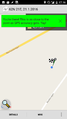
The expedition was a success
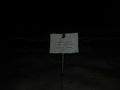
Sign posted on the electric fence


Achievements
thestormer earned the Land geohash achievement
|

thestormer earned the Frozen Geohash Achievement
by reaching the (62, 21) geohash on 2016-01-21 while the temperature was -20°C.