Difference between revisions of "2016-06-30 51 13"
imported>Danatar (Report!) |
imported>FippeBot m (Location) |
||
| (One intermediate revision by one other user not shown) | |||
| Line 55: | Line 55: | ||
===tracklog=== | ===tracklog=== | ||
| − | + | [http://www.mygpsfiles.com/app/#https://www.dropbox.com/sh/l38ubdidvmv439v/AAClelpNQzq7wOjLoC-9scW3a/2016/2016-06-30_51_13-triton.gpx triton tracklog] | |
[[Category:Expeditions]] | [[Category:Expeditions]] | ||
| Line 61: | Line 61: | ||
[[Category:Coordinates reached]] | [[Category:Coordinates reached]] | ||
[[Category:Danatar]] | [[Category:Danatar]] | ||
| + | {{location|DE|SN|DD}} | ||
Latest revision as of 00:54, 16 August 2019
| Thu 30 Jun 2016 in Dresden: 51.0200056, 13.8917084 geohashing.info google osm bing/os kml crox |
Location
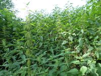
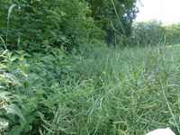
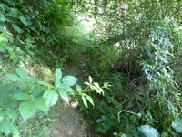
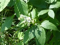
Today's location is in a patch of nettles between a field and a meadow near Dresden-Pillnitz
Country: Germany; state: Sachsen (Saxony, EU:DE:SN); district: Dresden; Ortschaft: Schönfeld/Schullwitz
Weather: clouded, a bit of rain on the way back
Expedition
Danatar
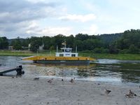
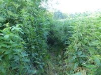
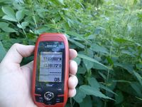
After a meeting at work I jumped on my bike and started to cycle towards the hashpoint along the Elbe cycle route. The weather was clouded but still nice. Cycling felt a little more difficult than usual which at first I attributed to the wind but which probably had to do with having only slept for 3 hours the night before. After half an hour I reached the Kleinzschachwitz ferry with which I crossed the Elbe. Then I cylced around the Pillnitz Castle park. From the center of Pillnitz the route led me uphill, at first on a normal road but then on a tiny track that was closed to cars. That track was cobbled and very steep and I just didn't have the energy to cycle uphill on it. Yeah, definitely lack of sleep, I was feeling totally exhausted. After a long while I reached the more level part of the hill and cycled the last part. I left the bike next to the road and walked over a meadow towards the hashpoint. Along the side of the meadow and at the same time along the adjacent field (with plants I don't know the name of) were trees and now or then patches of nettles. When I came near to the spot there was a particularly large patch consisting of trees, bushes, bramble-like plants and nettles. Next to that patch I was still 4 meters south of the hashpoint. I tried a little geohashing dance on the spot but the coordinates didn't come to me. Then I tried to walk along the edge of the field, between the crops and the nettles (while pushing the latter aside) but I still didn't get near enough. Finally I just trampled a path through the nettles which were as tall as I am. I made it with only one small contact to a nettle and that stang only a bit. After taking pictures I went back out of the patch. When I walked around the patch for a last time the coordinates had jumped and I was at another "correct coordinates" location, now without any evil plants!
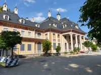
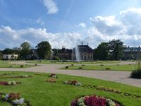
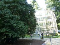
I went back to my bike and rolled back down the hill. It was still steep so I kept braking near constantly so that I wouldn't become too fast and fall down the steep ravine next to the track. Back in Pillnitz I decided to finally (after more than two years of living in Dresden) visit Pillnitz Castle, a baroque palace from the 18th century. As it was already 30 minutes before closing time I didn't buy a ticket for the buildings, just one for the park. That park has been a leading botanical collection for more than 200 years and consists of parts in various styles. I took a walk between the hedges and along the winded paths until I came to the famous Pillnitz camellia (one of the oldest in Europe, >230 years) and its movable glass house. Then I visited the palm house, at the time of construction the largest greenhouse in Germany before walking past the Chinese pond, around the baroque garden and back to my bike. I took the ferry back to the other side of the Elbe and started cycling again. When I was back in the more densely built-up part of Dresden it started to rain but not for long.
In total, I cycled 24.8 km.
|
