Difference between revisions of "2016-09-01 52 1"
From Geohashing
imported>Sourcerer (→Planning) |
imported>Sourcerer m ([live picture] Arrived. [http://www.openstreetmap.org/?lat=52.49545455&lon=1.23096228&zoom=16&layers=B000FTF @52.4955,1.2310]) |
||
| Line 24: | Line 24: | ||
== Photos == | == Photos == | ||
<gallery caption="Photo Gallery" perrow="3"> | <gallery caption="Photo Gallery" perrow="3"> | ||
| + | |||
| + | Image:2016-09-01_52_1_Sourcerer_1472761685775.jpg | Arrived. [http://www.openstreetmap.org/?lat=52.49545455&lon=1.23096228&zoom=16&layers=B000FTF @52.4955,1.2310] | ||
</gallery> | </gallery> | ||
Revision as of 20:29, 1 September 2016
| Thu 1 Sep 2016 in Norwich, UK: 52.4954467, 1.2309569 geohashing.info google osm bing/os kml crox |
Location
A field behind a sewage works, Long Stratton, Norfolk, UK.
Participants
Plans
Expedition
Photos
- Photo Gallery
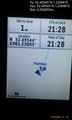
Arrived. @52.4955,1.2310

Achievements
Expeditions and Plans
| 2016-09-01 | ||
|---|---|---|
| Norwich, United Kingdom | Sourcerer | A field behind a sewage works, Long Stratton, Norfolk, UK. |
Sourcerer's Expedition Links
2016-08-25 52 1 - 2016-09-01 52 1 - 2016-09-02 52 1 - KML file download of Sourcerer's expeditions for use with Google Earth.