Difference between revisions of "2016-12-11 52 1"
From Geohashing
imported>Sourcerer m (→Planning) |
imported>Sourcerer m ([live picture] Arrived. [http://www.openstreetmap.org/?lat=52.29618788&lon=1.60327971&zoom=16&layers=B000FTF @52.2962,1.6033]) |
||
| Line 25: | Line 25: | ||
== Photos == | == Photos == | ||
<gallery caption="Photo Gallery" perrow="3"> | <gallery caption="Photo Gallery" perrow="3"> | ||
| + | |||
| + | Image:2016-12-11_52_1_Sourcerer_1481414327255.jpg | Arrived. [http://www.openstreetmap.org/?lat=52.29618788&lon=1.60327971&zoom=16&layers=B000FTF @52.2962,1.6033] | ||
</gallery> | </gallery> | ||
Revision as of 00:01, 11 December 2016
| Sun 11 Dec 2016 in Norwich, UK: 52.2963631, 1.6034981 geohashing.info google osm bing/os kml crox |
Location
Woodland in Dunwich Forest, Suffolk, UK.
Participants
Plans
Two of two spanning midnight - 2016-12-10 52 1 - 2016-12-11 52 1 - ETA 00:00.
Expedition
Photos
- Photo Gallery
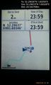
Arrived. @52.2962,1.6033

Achievements
Expeditions and Plans
| 2016-12-11 | ||
|---|---|---|
| Mannheim, Germany | DODO | On a cart course near Reilingen. |
| Norwich, United Kingdom | Sourcerer | Woodland in Dunwich Forest, Suffolk, UK. |
Sourcerer's Expedition Links
2016-12-10 52 1 - 2016-12-11 52 1 - 2016-12-12 52 1 - KML file download of Sourcerer's expeditions for use with Google Earth.