Difference between revisions of "2017-01-01 38 -122"
From Geohashing
imported>Blueberrynewt (→Photos) |
imported>FippeBot m (Location) |
||
| (One intermediate revision by one other user not shown) | |||
| Line 34: | Line 34: | ||
== Expedition == | == Expedition == | ||
A short drive off of Hwy 12, and a few attempts at finding the right turn, brought us to the location. We saw readings within 3 meters without getting out, then stopped briefly to do so for better GPS reception and photography. | A short drive off of Hwy 12, and a few attempts at finding the right turn, brought us to the location. We saw readings within 3 meters without getting out, then stopped briefly to do so for better GPS reception and photography. | ||
| − | |||
| − | |||
| − | |||
== Photos == | == Photos == | ||
| Line 53: | Line 50: | ||
{{#vardefine:ribbonwidth|800px}} | {{#vardefine:ribbonwidth|800px}} | ||
<!-- Add any achievement ribbons you earned below, or remove this section --> | <!-- Add any achievement ribbons you earned below, or remove this section --> | ||
| + | {{land geohash | ||
| + | | latitude = 38 | ||
| + | | longitude = -122 | ||
| + | | date = 2017-01-01 | ||
| + | | name = coyotebush and blueberrynewt | ||
| + | }} | ||
| + | {{consecutive geohash | count = 2 | latitude = 38 | longitude = -122 | date = 2016-12-31 | name = coyotebush and blueberrynewt }} | ||
| + | |||
<!-- =============== USEFUL CATEGORIES FOLLOW ================ | <!-- =============== USEFUL CATEGORIES FOLLOW ================ | ||
Delete the next line ONLY if you have chosen the appropriate categories below. If you are unsure, don't worry. People will read your report and help you with the classification. --> | Delete the next line ONLY if you have chosen the appropriate categories below. If you are unsure, don't worry. People will read your report and help you with the classification. --> | ||
| − | |||
<!-- ==REQUEST FOR TWITTER BOT== Please leave either the New report or the Expedition planning category in as long as you work on it. This helps the twitter bot a lot with announcing the right outcome at the right moment. --> | <!-- ==REQUEST FOR TWITTER BOT== Please leave either the New report or the Expedition planning category in as long as you work on it. This helps the twitter bot a lot with announcing the right outcome at the right moment. --> | ||
<!-- Potential categories. Please include all the ones appropriate to your expedition --> | <!-- Potential categories. Please include all the ones appropriate to your expedition --> | ||
| − | |||
| − | |||
| − | |||
[[Category:Expeditions]] | [[Category:Expeditions]] | ||
| − | |||
[[Category:Expeditions with photos]] | [[Category:Expeditions with photos]] | ||
| − | |||
| − | |||
| − | |||
| − | |||
| − | |||
[[Category:Coordinates reached]] | [[Category:Coordinates reached]] | ||
| − | + | {{location|US|CA|SO}} | |
| − | |||
| − | |||
| − | |||
| − | |||
| − | |||
| − | |||
| − | |||
| − | |||
| − | |||
| − | |||
| − | |||
| − | |||
| − | |||
| − | |||
| − | |||
| − | |||
| − | |||
Latest revision as of 01:56, 16 August 2019
| Sun 1 Jan 2017 in 38,-122: 38.4286439, -122.7963389 geohashing.info google osm bing/os kml crox |
Location
On a residential road west of Santa Rosa.
Participants
Plans
Visit briefly. Perhaps approximately midday.
Expedition
A short drive off of Hwy 12, and a few attempts at finding the right turn, brought us to the location. We saw readings within 3 meters without getting out, then stopped briefly to do so for better GPS reception and photography.
Photos
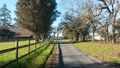
the road of the moment.
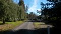
road in the other direction.
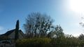
tree, mistletoe, blue sky.
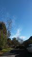
clouds.
A particularly lucky GPS reading


Achievements
coyotebush and blueberrynewt earned the Land geohash achievement
|
coyotebush and blueberrynewt earned the Consecutive geohash achievement
|