Difference between revisions of "2016-12-31 38 -122"
imported>Coyotebush m (→Photos: reorder) |
imported>Coyotebush (finish) |
||
| Line 46: | Line 46: | ||
For the return trip, we found a closer scrambling route with less backtracking and walked out the road into the sunset. At the gate, a small sign was discovered that in fact invited adjacent parking. It was a short enough walk back to the car. | For the return trip, we found a closer scrambling route with less backtracking and walked out the road into the sunset. At the gate, a small sign was discovered that in fact invited adjacent parking. It was a short enough walk back to the car. | ||
| − | |||
| − | |||
| − | |||
== Photos == | == Photos == | ||
| Line 92: | Line 89: | ||
{{#vardefine:ribbonwidth|800px}} | {{#vardefine:ribbonwidth|800px}} | ||
<!-- Add any achievement ribbons you earned below, or remove this section --> | <!-- Add any achievement ribbons you earned below, or remove this section --> | ||
| + | {{land geohash | ||
| + | | latitude = 38 | ||
| + | | longitude = -122 | ||
| + | | date = 2016-12-31 | ||
| + | | name = coyotebush and blueberrynewt | ||
| + | }} | ||
<!-- =============== USEFUL CATEGORIES FOLLOW ================ | <!-- =============== USEFUL CATEGORIES FOLLOW ================ | ||
Delete the next line ONLY if you have chosen the appropriate categories below. If you are unsure, don't worry. People will read your report and help you with the classification. --> | Delete the next line ONLY if you have chosen the appropriate categories below. If you are unsure, don't worry. People will read your report and help you with the classification. --> | ||
| − | |||
<!-- ==REQUEST FOR TWITTER BOT== Please leave either the New report or the Expedition planning category in as long as you work on it. This helps the twitter bot a lot with announcing the right outcome at the right moment. --> | <!-- ==REQUEST FOR TWITTER BOT== Please leave either the New report or the Expedition planning category in as long as you work on it. This helps the twitter bot a lot with announcing the right outcome at the right moment. --> | ||
<!-- Potential categories. Please include all the ones appropriate to your expedition --> | <!-- Potential categories. Please include all the ones appropriate to your expedition --> | ||
| − | |||
<!-- If all those plans are never acted upon, change [[Category:Expedition planning]] to [[Category:Not reached - Did not attempt]]. --> | <!-- If all those plans are never acted upon, change [[Category:Expedition planning]] to [[Category:Not reached - Did not attempt]]. --> | ||
| − | |||
[[Category:Expeditions]] | [[Category:Expeditions]] | ||
| − | |||
[[Category:Expeditions with photos]] | [[Category:Expeditions with photos]] | ||
| − | |||
| − | |||
| − | |||
| − | |||
| − | |||
[[Category:Coordinates reached]] | [[Category:Coordinates reached]] | ||
| − | |||
| − | |||
| − | |||
| − | |||
| − | |||
| − | |||
| − | |||
| − | |||
| − | |||
| − | |||
| − | |||
| − | |||
| − | |||
| − | |||
| − | |||
| − | |||
| − | |||
| − | |||
Revision as of 05:41, 2 January 2017
| Sat 31 Dec 2016 in 38,-122: 38.1014338, -122.4896370 geohashing.info google osm bing/os kml crox |
Location
Near the shore of Day('s) Island, east of Novato.
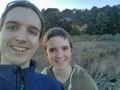
Participants
Plans
Aim to arrive slightly before 16:00 to maximize meetup potential, subject to New Year's Eve plans. Tide should be relatively high but falling then, judging by a couple sources I found. Sunset is around 17:00.
This is CA Fish & Wildlife land, but fortunately closed to hunting. Otherwise the Internet knows very little about the location. Google Street View reaches as far as the intersection of Iolanthus Ave/Norton Ave/Days Island Rd, at which the latter has what appears to be a "Road Closed to Unauthorized Vehicles" sign. So the plan is to park near there at 15:30 or so and walk the last 0.5mi out the road.
Investigate shore access from both ends of the road, or near the single house just inland of the hashpoint. Try not to get stuck in the mud.
(Some nearby hashpoints also look interesting: 39 -123 can likely be parked on top of, and 38 -121 also might be reachable. But those are a long way away.)
Expedition
The steep, winding roads of Black Point-Green Point passed fancy homes and friendly joggers, leading to a closed gate at Days Island Rd. Not seeing a sure place to park nearby, we instead tried Norton Ave, gravel and lined with simpler homes, finding parking near a trail of sorts at the north end at 15:50.
The two of us traipsed through the grass along the northern approach to the "island". Hiding in the grass were a collapsing wooden structure, an unidentifiable rusting one, and a deer. As we met the road again, we waved to a man and dog who retreated to the nearby house. A steep drop was apparent beyond the house. Not wanting to traverse the shore from so far north, we walked along the road and took the south fork past the only other house. This brought us directly inland of the hashpoint, but on closer examination the cliff was still quite steep. Slightly farther along, however, we identified a plausible scrambling route and descended to the base.
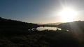
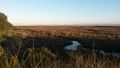
From there, only brush stood between us and the point. Some appeared dead and might have been below the high tide line. We encountered water with less than 9 meters remaining, but that was within current GPS accuracy so we decided to call it plenty close enough at 16:40.
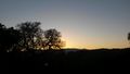
For the return trip, we found a closer scrambling route with less backtracking and walked out the road into the sunset. At the gate, a small sign was discovered that in fact invited adjacent parking. It was a short enough walk back to the car.
Photos
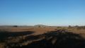
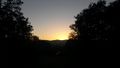
view from where we parked, toward the bay.
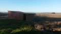
same view, a little to the left, with shed.
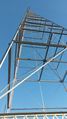
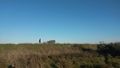
tower.
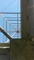
tower, from within.
coyotebush on trail.
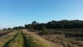
trail.
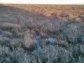
low sun over still pool.
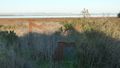
mysterious rusty thing in field. (there were a lot of mysterious rusty things. also a very old wooden something that might have been a large boat or a small house.)
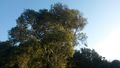
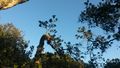
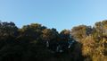
tree with blue sky.
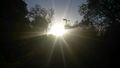
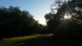
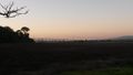
sun over road.
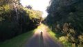
road, feat. blueberrynewt's shadow.

coyotebush on road.
fork in the road
sky, trees, you know.
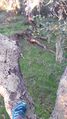
shoe, in tree.
sky from within tree.
hashpoint! right out there!
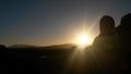
coyotebush silhouetted against setting sun.
treetreetreetreetreeeeeee
just a little farther out
on site
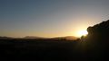
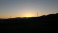
view from hashpoint. setting sun bein all pretty and stuff.
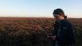
coyotebush searching for a gps fix.
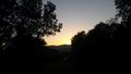
sky on the walk back to the car (1).
sky on the walk back to the car (2).
sky on the walk back to the car (3).
sky on the walk back to the car (4).
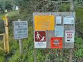
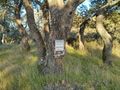
entrance signs
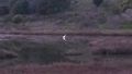
egret with reflection.
bridge in sunset.


Achievements
coyotebush and blueberrynewt earned the Land geohash achievement
|