Difference between revisions of "2017-02-08 51 13"
imported>Danatar (Report!) |
imported>FippeBot m (Location) |
||
| (One intermediate revision by one other user not shown) | |||
| Line 35: | Line 35: | ||
|Image:2017-02-08_51_13_tron.jpg|Tron expedition | |Image:2017-02-08_51_13_tron.jpg|Tron expedition | ||
}} | }} | ||
| + | The colors are off because the white balance was set to "light bulb" as I found out in March. | ||
===tracklog=== | ===tracklog=== | ||
| − | + | everytrail.com has been taken over and the new owner (alltrails) doesn't have a private mode, so it might take a while until I find a new site to upload the tracks without spreading them to all the world | |
| + | |||
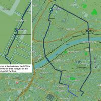
| + | I now found mygpsfiles.com which is not optimal (waypoints = the hashpoint are not shown) but better than nothing: [http://www.mygpsfiles.com/app/#https://www.dropbox.com/sh/l38ubdidvmv439v/AAC05J_I25iQ6Skn88iTn32Ca/2017/2017-02-08_51_13-triton.gpx Triton trackog] | ||
[[Category:Expeditions]] | [[Category:Expeditions]] | ||
| Line 45: | Line 48: | ||
[[Category:Coordinates reached]] | [[Category:Coordinates reached]] | ||
[[Category:Danatar]] | [[Category:Danatar]] | ||
| + | {{location|DE|SN|DD}} | ||
Latest revision as of 02:07, 16 August 2019
| Wed 8 Feb 2017 in Dresden: 51.0740375, 13.7563917 geohashing.info google osm bing/os kml crox |
Location
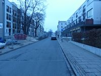
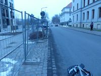
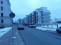
Today's location is on the street of Hans-Oster-Straße in Dresden-Neustadt, next to a vegetation zone that interupts a parking lane.
Country: Germany; state: Sachsen (Saxony, EU:DE:SN); district: Dresden; Ortsamt: Neustadt; Stadtteil: Albertstadt.
Weather: Clouded, cold, -2 °C.
Plans: Cycle there
Expedition
Danatar
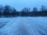
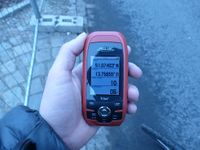
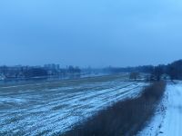
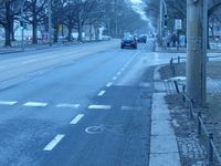
I left the door as the church bells were striking 10 a.m. As my not-covered ears kept telling me during the trip it was a cold morning, but this didn't stop me from cycling through Johannstadt and Neustadt towards the hashpoint. In the Alaunpark I almost slipped on the uneven ice that was still covering the path. A few moments later I reached the hashstreet. From the satellite image I instantly recognized the hashpoint, next to a small green patch just across from that big builing. The huge construction site from the satellite image had been replaced by houses. When I took out my GPS unit to take a picture of proof it showed the hashpoint to be 10 meters away. As I had planned a tron route that I didn't want to leave and there was a fence around the newly-built houses I decided to stick to the satellite image (as you can see on the tracklog the GPS was off). Without deviating from my route I continued along the street and returned home via Stauffenbergallee and Waldschlösschenbrücke. Just when I arrived at home the church bells were striking 10:45, making this an expedition of exactly 45 minutes. In total, I cycled 9.2 km.
|
The colors are off because the white balance was set to "light bulb" as I found out in March.
tracklog
everytrail.com has been taken over and the new owner (alltrails) doesn't have a private mode, so it might take a while until I find a new site to upload the tracks without spreading them to all the world
I now found mygpsfiles.com which is not optimal (waypoints = the hashpoint are not shown) but better than nothing: Triton trackog
