Difference between revisions of "2017-04-02 -37 145"
imported>Felix Dance m (→Expedition) |
imported>Thunk |
||
| Line 20: | Line 20: | ||
== Location == | == Location == | ||
<!-- where you've surveyed the hash to be --> | <!-- where you've surveyed the hash to be --> | ||
| + | Right outfield of Moorabbin Baseball Club field, Victoria, Australia | ||
== Participants == | == Participants == | ||
<!-- who attended: If you link to your wiki user name in this section, your expedition will be picked up by the various statistics generated for geohashing. You may use three tildes ~ as a shortcut to automatically insert the user signature of the account you are editing with. | <!-- who attended: If you link to your wiki user name in this section, your expedition will be picked up by the various statistics generated for geohashing. You may use three tildes ~ as a shortcut to automatically insert the user signature of the account you are editing with. | ||
--> | --> | ||
| − | + | [[User:Thunk|Thunk]] ([[User talk:Thunk|talk]]) | |
| − | + | [[User:Felix Dance|Felix Dance]] ([[User talk:Felix Dance|talk]]) | |
| − | |||
== Expedition == | == Expedition == | ||
<!-- how it all turned out. your narrative goes here. --> | <!-- how it all turned out. your narrative goes here. --> | ||
| − | + | === thunk === | |
| + | Well, it's best summarized below. Also refer to the images section and tracklog. | ||
*Pre-Opening Day hash on a baseball field. It'll be walk till you drop as I procrastinate on Sunday with a slow expedition. -- [[User:Thunk|Thunk]] ([[User talk:Thunk|talk]]) 09:34, 1 April 2017 (GMT+00:00) | *Pre-Opening Day hash on a baseball field. It'll be walk till you drop as I procrastinate on Sunday with a slow expedition. -- [[User:Thunk|Thunk]] ([[User talk:Thunk|talk]]) 09:34, 1 April 2017 (GMT+00:00) | ||
| Line 37: | Line 38: | ||
*Time for the traditional Australian 'brekky'. It's not just a matter of the local customs but me needing to actually eat. -- [[User:Thunk|Thunk]] ([[User talk:Thunk|talk]]) [http://www.openstreetmap.org/?lat=-37.92553460&lon=145.11966180&zoom=16&layers=B000FTF @-37.9255,145.1197] 22:33, 1 April 2017 (GMT+00:00) | *Time for the traditional Australian 'brekky'. It's not just a matter of the local customs but me needing to actually eat. -- [[User:Thunk|Thunk]] ([[User talk:Thunk|talk]]) [http://www.openstreetmap.org/?lat=-37.92553460&lon=145.11966180&zoom=16&layers=B000FTF @-37.9255,145.1197] 22:33, 1 April 2017 (GMT+00:00) | ||
| + | |||
| + | *Ow...Ow...Ow... | ||
| + | 34 km is quite enough for one day. -- [[User:Thunk|Thunk]] ([[User talk:Thunk|talk]]) [http://www.openstreetmap.org/?lat=-37.81282920&lon=144.96759060&zoom=16&layers=B000FTF @-37.8128,144.9676] 04:49, 2 April 2017 (GMT+00:00) | ||
| + | |||
| + | *It turns out that after I wrote that, I started feeling restless again. So on another whim, I started walking the 17 km from South Yarra station to my temporary hideaway. The first 5 km were relatively all right, but exhaustion soon set in, and I was at my limits by the time I completed my journey. The total distance on foot is currently unclear due to GPS jitters but is likely greater than 50 km. | ||
| + | |||
| + | And considering how sore I was for two days afterwards, it probably wasn't worth it. Though proper shoe choice left me with only one large blister on my right foot (and only a very small one on the left foot). | ||
| + | |||
| + | ===Felix Dance=== | ||
*Hampton geohash success! -- [[User:Felix Dance|Felix Dance]] ([[User talk:Felix Dance|talk]]) [http://www.openstreetmap.org/?lat=-37.94071990&lon=145.02633930&zoom=16&layers=B000FTF @-37.9407,145.0263] 12:45, 2 April 2017 (GMT+10:00) | *Hampton geohash success! -- [[User:Felix Dance|Felix Dance]] ([[User talk:Felix Dance|talk]]) [http://www.openstreetmap.org/?lat=-37.94071990&lon=145.02633930&zoom=16&layers=B000FTF @-37.9407,145.0263] 12:45, 2 April 2017 (GMT+10:00) | ||
| Line 42: | Line 52: | ||
After a fair ride along the Nepean Highway, I turned off and arrived at the park nestled between Hampton East and Moorabin. The sun was sunny so I took a nap on the grass - a hashnap. But soon I was back on the bike and riding directly north into the tailwind, all the way up Burke Rd, a tour of the Eastern suburbs, to a first birthday party in Ivanhoe. I'll work out my total distance in a bit, but it must be about 60 Kms, or about 90 for the day. | After a fair ride along the Nepean Highway, I turned off and arrived at the park nestled between Hampton East and Moorabin. The sun was sunny so I took a nap on the grass - a hashnap. But soon I was back on the bike and riding directly north into the tailwind, all the way up Burke Rd, a tour of the Eastern suburbs, to a first birthday party in Ivanhoe. I'll work out my total distance in a bit, but it must be about 60 Kms, or about 90 for the day. | ||
| − | |||
| − | |||
| − | |||
| − | |||
| − | |||
== Tracklog == | == Tracklog == | ||
Revision as of 13:51, 4 April 2017
| Sun 2 Apr 2017 in -37,145: -37.9407021, 145.0263431 geohashing.info google osm bing/os kml crox |
Location
Right outfield of Moorabbin Baseball Club field, Victoria, Australia
Participants
Thunk (talk) Felix Dance (talk)
Expedition
thunk
Well, it's best summarized below. Also refer to the images section and tracklog.
- Pre-Opening Day hash on a baseball field. It'll be walk till you drop as I procrastinate on Sunday with a slow expedition. -- Thunk (talk) 09:34, 1 April 2017 (GMT+00:00)
- Good morning everyone. I'm off on this rather long walk. Let's see how long it can be. -- Thunk (talk) @-37.9108,145.1356 22:02, 1 April 2017 (GMT+00:00)
- Time for the traditional Australian 'brekky'. It's not just a matter of the local customs but me needing to actually eat. -- Thunk (talk) @-37.9255,145.1197 22:33, 1 April 2017 (GMT+00:00)
- Ow...Ow...Ow...
34 km is quite enough for one day. -- Thunk (talk) @-37.8128,144.9676 04:49, 2 April 2017 (GMT+00:00)
- It turns out that after I wrote that, I started feeling restless again. So on another whim, I started walking the 17 km from South Yarra station to my temporary hideaway. The first 5 km were relatively all right, but exhaustion soon set in, and I was at my limits by the time I completed my journey. The total distance on foot is currently unclear due to GPS jitters but is likely greater than 50 km.
And considering how sore I was for two days afterwards, it probably wasn't worth it. Though proper shoe choice left me with only one large blister on my right foot (and only a very small one on the left foot).
Felix Dance
- Hampton geohash success! -- Felix Dance (talk) @-37.9407,145.0263 12:45, 2 April 2017 (GMT+10:00)
Some explanation: I was out in Fairfield after riding in the Mike Hall memorial ride along the Yarra - a tribute to Indian Pacific Wheel Race competitor and car-crash fatality victim Mike Hall - when I discovered the hash. I left the Abbotsford Convent cafe and headed south towards Hampton along Church/Chapel Streets, picking up an Astor calendar along the way (heavy Melbourne referencing).
After a fair ride along the Nepean Highway, I turned off and arrived at the park nestled between Hampton East and Moorabin. The sun was sunny so I took a nap on the grass - a hashnap. But soon I was back on the bike and riding directly north into the tailwind, all the way up Burke Rd, a tour of the Eastern suburbs, to a first birthday party in Ivanhoe. I'll work out my total distance in a bit, but it must be about 60 Kms, or about 90 for the day.
Tracklog
Photos
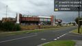
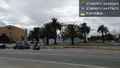
So that's where they play this footy... @-37.9364,145.0426
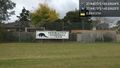
And here we are. @-37.9407,145.0263
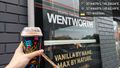
Squishy time!
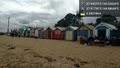
Why stop at the hash?
And I've reached St. Kilda. Which will give out first--my legs or my phone battery? @-37.8693,144.9757
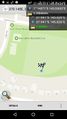
GPS proof - 0.66m away @-37.9407,145.0263
- Error creating thumbnail: Unable to save thumbnail to destination
Me with bike at the hash @-37.9407,145.0263


Achievements