Difference between revisions of "2017-07-12 52 1"
From Geohashing
imported>Sourcerer (→Expedition planning) |
imported>Sourcerer m ([live picture] arrived [http://www.openstreetmap.org/?lat=52.44065166&lon=1.47428691&zoom=16&layers=B000FTF @52.4407,1.4743]) |
||
| Line 25: | Line 25: | ||
== Photos == | == Photos == | ||
<gallery caption="Gallery" widths="200px" heights="200px" perrow="3"> | <gallery caption="Gallery" widths="200px" heights="200px" perrow="3"> | ||
| + | |||
| + | Image:2017-07-12_52_1_Sourcerer_1499897854131.jpg | arrived [http://www.openstreetmap.org/?lat=52.44065166&lon=1.47428691&zoom=16&layers=B000FTF @52.4407,1.4743] | ||
</gallery> | </gallery> | ||
Revision as of 22:21, 12 July 2017
| Wed 12 Jul 2017 in Norwich, UK: 52.4406650, 1.4743164 geohashing.info google osm bing/os kml crox |
Location
A field SE of Bungay, Suffolk, UK.
Participants
Plans
Expedition 1 of 2 spanning midnight 2017-07-12 52 1 - 2017-07-13 52 1 - ETA 23:15
Expedition
Photos
- Gallery
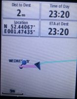
arrived @52.4407,1.4743

Achievements
Expeditions and Plans
| 2017-07-12 | ||
|---|---|---|
| Norwich, United Kingdom | Sourcerer | A field SE of Bungay, Suffolk, UK. |
Sourcerer's Expedition Links
2017-06-24 52 1 - 2017-07-12 52 1 - 2017-07-13 52 1 - KML file download of Sourcerer's expeditions for use with Google Earth.