Difference between revisions of "2017-07-25 47 -122"
From Geohashing
imported>Thomcat ([live picture]Location [http://www.openstreetmap.org/?lat=47.75830620&lon=-122.26094840&zoom=16&layers=B000FTF @47.7583,-122.2609]) |
imported>Thomcat ([live picture]Burke Gilman trail [http://www.openstreetmap.org/?lat=47.75804470&lon=-122.26113070&zoom=16&layers=B000FTF @47.7580,-122.2611]) |
||
| Line 34: | Line 34: | ||
Image:2017-07-25_47_-122_thomcat_1500994715858.jpg|Location [http://www.openstreetmap.org/?lat=47.75830620&lon=-122.26094840&zoom=16&layers=B000FTF @47.7583,-122.2609] | Image:2017-07-25_47_-122_thomcat_1500994715858.jpg|Location [http://www.openstreetmap.org/?lat=47.75830620&lon=-122.26094840&zoom=16&layers=B000FTF @47.7583,-122.2609] | ||
| + | |||
| + | Image:2017-07-25_47_-122_thomcat_1500994870434.jpg|Burke Gilman trail [http://www.openstreetmap.org/?lat=47.75804470&lon=-122.26113070&zoom=16&layers=B000FTF @47.7580,-122.2611] | ||
</gallery> | </gallery> | ||
Revision as of 15:01, 25 July 2017
| Tue 25 Jul 2017 in Seattle: 47.7582970, -122.2609161 geohashing.info google osm bing/os kml crox |
Location
Between highway 522 and the Burke Gilman trail; the sidewalk in front of a small building.
Participants
Plans
Initial scouting on the way to work; perhaps meet User:BenKaiser later in the day.
Expedition
Tracklog
Photos
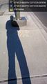
Mark and shadow @47.7583,-122.2610

Geohasher @47.7583,-122.2609
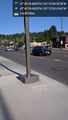
Location @47.7583,-122.2609
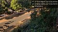
Burke Gilman trail @47.7580,-122.2611


Achievements