Difference between revisions of "2018-01-11 29 -96"
From Geohashing
imported>Thunk ([live picture]Fence [http://www.openstreetmap.org/?lat=29.93337450&lon=-96.87355600&zoom=16&layers=B000FTF @29.9334,-96.8736]) |
imported>Jiml (Fill in report areas from available data) |
||
| Line 15: | Line 15: | ||
}} | }} | ||
| − | + | ||
__NOTOC__ | __NOTOC__ | ||
== Location == | == Location == | ||
<!-- where you've surveyed the hash to be --> | <!-- where you've surveyed the hash to be --> | ||
| + | |||
| + | North of La Grange | ||
== Participants == | == Participants == | ||
| − | + | ||
| − | + | * [[User:Thunk|Thunk]] | |
== Plans == | == Plans == | ||
<!-- what were the original plans --> | <!-- what were the original plans --> | ||
| + | |||
| + | Unknown | ||
== Expedition == | == Expedition == | ||
| Line 33: | Line 37: | ||
*Hash attempt unsuccessful. Area fenced off. -- [[User:Thunk|Thunk]] ([[User talk:Thunk|talk]]) [http://www.openstreetmap.org/?lat=29.93337480&lon=-96.87355580&zoom=16&layers=B000FTF @29.9334,-96.8736] 22:22, 11 January 2018 (GMT+00:00) | *Hash attempt unsuccessful. Area fenced off. -- [[User:Thunk|Thunk]] ([[User talk:Thunk|talk]]) [http://www.openstreetmap.org/?lat=29.93337480&lon=-96.87355580&zoom=16&layers=B000FTF @29.9334,-96.8736] 22:22, 11 January 2018 (GMT+00:00) | ||
| − | |||
| − | |||
| − | + | = Photos == | |
| − | + | ||
| − | |||
| − | |||
<gallery perrow="5"> | <gallery perrow="5"> | ||
| − | |||
Image:2018-01-11_29_-96_thunk_1515709372431.jpg|Fence [http://www.openstreetmap.org/?lat=29.93337450&lon=-96.87355600&zoom=16&layers=B000FTF @29.9334,-96.8736] | Image:2018-01-11_29_-96_thunk_1515709372431.jpg|Fence [http://www.openstreetmap.org/?lat=29.93337450&lon=-96.87355600&zoom=16&layers=B000FTF @29.9334,-96.8736] | ||
</gallery> | </gallery> | ||
| Line 47: | Line 46: | ||
== Achievements == | == Achievements == | ||
{{#vardefine:ribbonwidth|800px}} | {{#vardefine:ribbonwidth|800px}} | ||
| − | |||
| − | + | * No Trespassing | |
| − | |||
| − | |||
| − | |||
| − | |||
| − | |||
| − | |||
| − | |||
| − | |||
| − | |||
| − | |||
| − | |||
[[Category:Expeditions]] | [[Category:Expeditions]] | ||
| − | |||
| − | |||
| − | |||
| − | |||
| − | |||
| − | |||
| − | |||
| − | |||
| − | |||
| − | |||
[[Category:Coordinates not reached]] | [[Category:Coordinates not reached]] | ||
| − | |||
| − | |||
| − | |||
| − | |||
| − | |||
[[Category:Not reached - No public access]] | [[Category:Not reached - No public access]] | ||
| − | |||
| − | |||
| − | |||
| − | |||
| − | |||
| − | |||
| − | |||
| − | |||
Revision as of 16:59, 15 January 2018
| Thu 11 Jan 2018 in 29,-96: 29.9331669, -96.8731236 geohashing.info google osm bing/os kml crox |
Location
North of La Grange
Participants
Plans
Unknown
Expedition
- Hash attempt unsuccessful. Area fenced off. -- Thunk (talk) @29.9334,-96.8736 22:22, 11 January 2018 (GMT+00:00)
Photos =
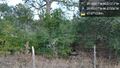
Fence @29.9334,-96.8736

Achievements
- No Trespassing