Difference between revisions of "2018-05-19 51 13"
From Geohashing
imported>Danatar ([live picture]Coordinates reached, now waiting for hash o'clock [http://www.openstreetmap.org/?lat=51.06876410&lon=13.87614280&zoom=16&layers=B000FTF @51.0688,13.8761]) |
imported>Danatar (pictures) |
||
| Line 1: | Line 1: | ||
| + | {{meetup graticule | ||
| + | | lat=51 | ||
| + | | lon=13 | ||
| + | | date=2018-02-02 | ||
| + | | graticule_name=Dresden | ||
| + | | graticule_link=Dresden, Germany | ||
| + | }}__NOTOC__ | ||
| + | == Location == | ||
| − | + | Today's location is in a meadow at Weißig, a former village nowadays incorporated into Dresden | |
| − | |||
| − | |||
| − | |||
| − | |||
| − | |||
| − | + | Country: Germany; state: Sachsen (Saxony, EU:DE:SN); district: Dresden; Ortschaft: Weißig | |
| − | |||
| − | |||
| − | |||
| − | |||
| − | |||
| − | |||
| − | + | Weather: mostly clouded during the day but sunny at the hashpoint | |
| − | |||
| − | |||
| − | |||
| − | == | + | == Expedition== |
| − | + | ===[[User:Danatar|Danatar]]=== | |
| − | |||
| − | + | ... | |
| − | |||
| − | |||
| − | |||
| − | |||
| − | |||
| − | |||
| − | |||
| − | |||
| − | |||
<gallery perrow="5"> | <gallery perrow="5"> | ||
| Line 43: | Line 27: | ||
</gallery> | </gallery> | ||
| − | |||
| − | |||
| − | |||
| − | |||
| − | |||
| − | |||
| − | |||
| − | + | {{gallery|width=200|height=200|lines=2 | |
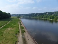
| − | + | |Image:2018-05-19_51_13_elbe.jpg|crossing the Elbe river | |
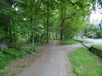
| − | + | |Image:2018-05-19_51_13_weg1.jpg| | |
| − | -- | + | |Image:2018-05-19_51_13_weg2.jpg| |
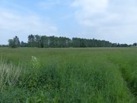
| + | |Image:2018-05-19_51_13_near.jpg|almost there | ||
| + | |Image:2018-05-19_51_13_gps.jpg|GPS | ||
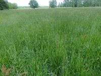
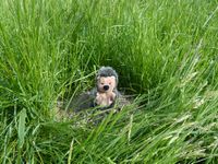
| + | |Image:2018-05-19_51_13_spot.jpg|the hashpoint | ||
| + | |Image:2018-05-19_51_13_hp.jpg|coordinates reached! | ||
| + | |Image:2018-05-19_51_13_pano.jpg|panorama | ||
| + | |Image:2018-05-19_51_13_scott.jpg|Scott playing near the hashpoint | ||
| + | |Image:2018-05-19_51_13_libelle.jpg|dragonfly | ||
| + | }} | ||
| + | |||
| + | |||
| − | + | ===tracklog=== | |
| + | ''will follow'' | ||
| − | <!-- | + | <!--[[Category:Expeditions]]-->[[Category:New report]] |
| − | [[Category:Expeditions]] | ||
| − | |||
[[Category:Expeditions with photos]] | [[Category:Expeditions with photos]] | ||
| − | |||
| − | |||
| − | |||
| − | |||
| − | |||
[[Category:Coordinates reached]] | [[Category:Coordinates reached]] | ||
| − | + | [[Category:Danatar]] | |
| − | |||
| − | |||
| − | |||
| − | |||
| − | |||
| − | |||
| − | |||
| − | |||
| − | |||
| − | |||
| − | |||
| − | |||
| − | |||
| − | |||
| − | [[Category: | ||
| − | |||
| − | |||
Revision as of 11:31, 30 June 2018
| Fri 2 Feb 2018 in Dresden: 51.0389827, 13.7401296 geohashing.info google osm bing/os kml crox |
Location
Today's location is in a meadow at Weißig, a former village nowadays incorporated into Dresden
Country: Germany; state: Sachsen (Saxony, EU:DE:SN); district: Dresden; Ortschaft: Weißig
Weather: mostly clouded during the day but sunny at the hashpoint
Expedition
Danatar
...
Coordinates reached, now waiting for hash o'clock @51.0688,13.8761
|
tracklog
will follow

