Difference between revisions of "2018-07-15 31 34"
From Geohashing
imported>Jordy |
imported>FippeBot m (Location) |
||
| (One intermediate revision by one other user not shown) | |||
| Line 60: | Line 60: | ||
Image:2018-07-15 31 34 Jordy 1531668554826.jpg | Path | Image:2018-07-15 31 34 Jordy 1531668554826.jpg | Path | ||
| − | Image:2018-07-15_31_34_Dubdub_1531672551362.jpg|Finally the entrance to Rehovot | + | Image:2018-07-15_31_34_Dubdub_1531672551362.jpg|Finally the entrance to Rehovot. But the north side, so we have to cross the city |
| − | But the north side, so we have to cross the city | ||
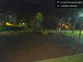
Image:2018-07-15_31_34_Dubdub_1531677210632.jpg|Havatselet neighborhood | Image:2018-07-15_31_34_Dubdub_1531677210632.jpg|Havatselet neighborhood | ||
| Line 118: | Line 117: | ||
(Don't forget to delete this final close comment marker) --> | (Don't forget to delete this final close comment marker) --> | ||
| + | {{location|IL|M|RH}} | ||
Latest revision as of 12:35, 14 July 2019
| Sun 15 Jul 2018 in 31,34: 31.8757748, 34.8170045 geohashing.info google osm bing/os kml crox |
Location
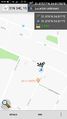
The point fell in the south-most side of Rehovot.
Participants
Plans
The plan was to advance through Tel Aviv to Rehovot using public transport.
Expedition
- Near Azrielli Towers, still a plenty of time ahead 32.09038330°N 34.79260670°E -- Dubdub (talk) 18:48, 15 July 2018 (GMT+03:00)
Tracklog
Photos
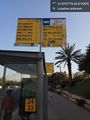
Tel Aviv bus station
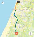
Path
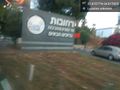
Finally the entrance to Rehovot. But the north side, so we have to cross the city

Havatselet neighborhood
We did it!

Geohash selfie
Luckiky it fell right inside a public garden


