Difference between revisions of "2018-07-21 51 14"
imported>Danatar (Planning) |
imported>Danatar (Report!) |
||
| Line 8: | Line 8: | ||
== Location == | == Location == | ||
| − | Today's location is in the forest at the border between Germany and the Czech Republic near Steinigtwolmsdorf (DE)/Lipová (CZ). According to G. Maps the spot is 2 meters from the border on the German side, according to OSM it's also barely on the German side. There is a walking path going along the border that according to OSM near the hashpoint is around 5 meters on the Czech side of the border. | + | Today's location is in the forest at the border between Germany and the Czech Republic near Steinigtwolmsdorf (DE)/Lipová (CZ). According to G. Maps the spot is 2 meters from the border on the German side, according to OSM it's also barely on the German side. There is a walking path going along the border <strike>that according to OSM near the hashpoint is around 5 meters on the Czech side of the border</strike>. |
| − | + | ||
| − | Country: Germany; state: Sachsen (Saxony, EU:DE:SN); district: | + | Country: Germany; state: Sachsen (Saxony, EU:DE:SN); district: Bautzen; municipality: Steinigtwolmsdorf _AND_ Country: Czech Republic; region: Ústecký kraj (EU:CZ:US); (district, obsolete: Okres Děčín) |
| − | + | ||
| − | Weather: | + | Weather: sunny, about 28-29 °C at the hashpoint |
== Plans == | == Plans == | ||
| − | * Danatar: I will take the train and bus to Steinigtwolmsdorf, then walk the rest of the way in order to be at the hashpoint around 15:30, then wait until 4 p.m. before returning. Why visit this hashpoint? First, I have time today and the weather is nice. Second, it's a Saturday so I will make progress towards the centurion achievement. And most important, I have | + | * Danatar: I will take the train and bus to Steinigtwolmsdorf, then walk the rest of the way in order to be at the hashpoint around 15:30, then wait until 4 p.m. before returning. Why visit this hashpoint? First, I have time today and the weather is nice. Second, it's a Saturday so I will make progress towards the centurion achievement. And most important, I have yet to reach hashpoints both in the Bautzen district part of this graticule and in the Czech part of this graticule. The spot is so near to the border that I guess because of GPS inaccuracy the exact coordinates will wander around a bit and fall not only on German but sometimes also on Czech ground, making this a hashpoint that is in two countries. <strike>From the maps the path is certainly on Czech ground so if I get the coordinates on or directly next to the path it would be in the Czech Republic. I hope there are some boundary stones to make it easier. </strike> The maps are inaccurate, the path is directly on the border according to the boundary stones. |
| + | |||
| − | |||
== Expedition== | == Expedition== | ||
===[[User:Danatar|Danatar]]=== | ===[[User:Danatar|Danatar]]=== | ||
| + | Very shortly after writing the abovementioned plans, I left home and cycled to the Dresden-Neustadt train station. I cycled very quickly and when I was standing at the ticket machine sweat was dripping from my head, good thing I had a towel with me. The train ride to Neukirch went smoothly, then I walked from the train station to the bus station. A short bus ride later I was at Steinigtwolmsdorf. From there I continued on foot, first along the streets and then along tracks that became smaller and smaller once I reached the forest. Although it was almost 30 °C it was very nice to walk through the shady forest. After almost 3 kms I reached the border and was delighted to find boundary stones along it. I followed the "border hiking trail" until I reached the area around the hashpoint. In contrast to the maps, according to the boundary stones the trail was directly on the border, not next to it. I started a binational GPS dance. The first reaching of the coordinates was when I was standing 2 meters of the track on the Czech (southern) side with 1 meter distance to the spot (0.00001° in north-south direction) directly after arrival at 15:30, only one minute later I reached the coordinates again about 3 meters on the German (northern) side. Hooray, the hashpoint is really in both countries! Besides taking the usual pictures, I continued GPS-dancing, reaching the spot once more 2 meters on the Czech side at 15:57, this time with the correct north coordinates and only 0.00001° (~70 cm) off in east-west direction. | ||
| + | At 4 p.m. I started to hike back to Steinigtwolmsdorf, as I wanted to catch the bus at 16:35. I used some of the same tracks and some parallel tracks as on the there journey, reaching the bus stop with one minute to spare. After another short bus ride I had to wait 40 minutes for the train that brought me back to Dresden. I was home 5.5 hours after leaving. | ||
| − | + | {{ | |
| + | gratuitous ribbon | color = green | icon = border.PNG | name = Danatar | latitude = 51 | longitude = 14 | date = 2018-07-21 | achievement = Multinational Hashpoint Ribbon | description = reaching a hashpoint that is on both sides of a national border at once | image = 2018-07-21_51_14_scott.jpg}} | ||
{{gallery|width=200|height=200|lines=2 | {{gallery|width=200|height=200|lines=2 | ||
| − | |Image:2018- | + | |Image:2018-07-21_51_14_weg1.jpg|From a street... |
| + | |Image:2018-07-21_51_14_weg2.jpg|to a field track... | ||
| + | |Image:2018-07-21_51_14_weg3.jpg|... | ||
| + | |Image:2018-07-21_51_14_weg4.jpg|to a forst track... | ||
| + | |Image:2018-07-21_51_14_weg5.jpg|through bushes and... | ||
| + | |Image:2018-07-21_51_14_weg6.jpg|between trees... | ||
| + | |Image:2018-07-21_51_14_weg7.jpg|to a tiny trail along the border | ||
| + | |Image:2018-07-21_51_14_near.jpg|that leads to the hashpoint | ||
| + | |Image:2018-07-21_51_14_gps-cz1.jpg|GPS on the Czech side of the border | ||
| + | |Image:2018-07-21_51_14_gps-de.jpg|GPS on the German side of the border | ||
| + | |Image:2018-07-21_51_14_gps-cz2.jpg|GPS on the Czech side again | ||
| + | |Image:2018-07-21_51_14_hp.jpg|Hooray, coordinates reached | ||
| + | |Image:2018-07-21_51_14_scott.jpg|Scott on the nearest boundary stone | ||
| + | |Image:2018-07-21_51_14_grenzweg.jpg|looking along the boundary stones | ||
| + | |Image:2018-07-21_51_14_pano-de.jpg|panorama, German half | ||
| + | |Image:2018-07-21_51_14_pano-cz.jpg|panorama, Czech half | ||
| + | |Image:2018-07-21_51_14_schild.jpg|sign near the spot | ||
| + | |Image:2018-07-21_51_14_schmetterling.jpg|butterfly on the border (borderfly?) | ||
| + | |Image:2018-07-21_51_14_blume.jpg|bell flowers on the track | ||
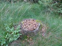
| + | |Image:2018-07-21_51_14_zapfen.jpg|some animal ate a cone here | ||
| + | |Image:2018-07-21_51_14_tagpfauenauge.jpg|peacock butterfly | ||
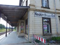
| + | |Image:2018-07-21_51_14_neukirch.jpg|Neukirch East train station (includes butterfly, can you find it?) | ||
}} | }} | ||
| Line 39: | Line 63: | ||
[[Category:Expeditions]] | [[Category:Expeditions]] | ||
[[Category:Expeditions with photos]] | [[Category:Expeditions with photos]] | ||
| − | [[Category:Coordinates reached]] | + | [[Category:Coordinates reached]] |
[[Category:Danatar]] | [[Category:Danatar]] | ||
Revision as of 18:31, 21 July 2018
| Sat 21 Jul 2018 in Cottbus: 51.0432936, 14.3567632 geohashing.info google osm bing/os kml crox |
Location
Today's location is in the forest at the border between Germany and the Czech Republic near Steinigtwolmsdorf (DE)/Lipová (CZ). According to G. Maps the spot is 2 meters from the border on the German side, according to OSM it's also barely on the German side. There is a walking path going along the border that according to OSM near the hashpoint is around 5 meters on the Czech side of the border.
Country: Germany; state: Sachsen (Saxony, EU:DE:SN); district: Bautzen; municipality: Steinigtwolmsdorf _AND_ Country: Czech Republic; region: Ústecký kraj (EU:CZ:US); (district, obsolete: Okres Děčín)
Weather: sunny, about 28-29 °C at the hashpoint
Plans
- Danatar: I will take the train and bus to Steinigtwolmsdorf, then walk the rest of the way in order to be at the hashpoint around 15:30, then wait until 4 p.m. before returning. Why visit this hashpoint? First, I have time today and the weather is nice. Second, it's a Saturday so I will make progress towards the centurion achievement. And most important, I have yet to reach hashpoints both in the Bautzen district part of this graticule and in the Czech part of this graticule. The spot is so near to the border that I guess because of GPS inaccuracy the exact coordinates will wander around a bit and fall not only on German but sometimes also on Czech ground, making this a hashpoint that is in two countries.
From the maps the path is certainly on Czech ground so if I get the coordinates on or directly next to the path it would be in the Czech Republic. I hope there are some boundary stones to make it easier.The maps are inaccurate, the path is directly on the border according to the boundary stones.
Expedition
Danatar
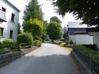
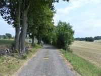
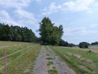
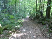
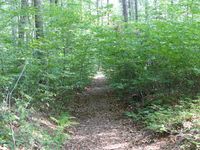
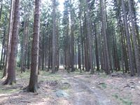
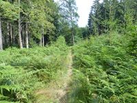
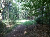
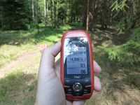
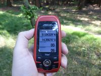
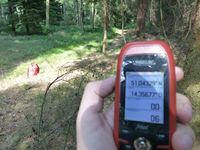
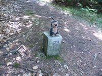
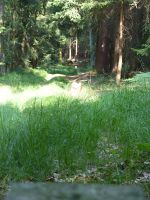
Very shortly after writing the abovementioned plans, I left home and cycled to the Dresden-Neustadt train station. I cycled very quickly and when I was standing at the ticket machine sweat was dripping from my head, good thing I had a towel with me. The train ride to Neukirch went smoothly, then I walked from the train station to the bus station. A short bus ride later I was at Steinigtwolmsdorf. From there I continued on foot, first along the streets and then along tracks that became smaller and smaller once I reached the forest. Although it was almost 30 °C it was very nice to walk through the shady forest. After almost 3 kms I reached the border and was delighted to find boundary stones along it. I followed the "border hiking trail" until I reached the area around the hashpoint. In contrast to the maps, according to the boundary stones the trail was directly on the border, not next to it. I started a binational GPS dance. The first reaching of the coordinates was when I was standing 2 meters of the track on the Czech (southern) side with 1 meter distance to the spot (0.00001° in north-south direction) directly after arrival at 15:30, only one minute later I reached the coordinates again about 3 meters on the German (northern) side. Hooray, the hashpoint is really in both countries! Besides taking the usual pictures, I continued GPS-dancing, reaching the spot once more 2 meters on the Czech side at 15:57, this time with the correct north coordinates and only 0.00001° (~70 cm) off in east-west direction.
At 4 p.m. I started to hike back to Steinigtwolmsdorf, as I wanted to catch the bus at 16:35. I used some of the same tracks and some parallel tracks as on the there journey, reaching the bus stop with one minute to spare. After another short bus ride I had to wait 40 minutes for the train that brought me back to Dresden. I was home 5.5 hours after leaving.
Danatar earned the Multinational Hashpoint Ribbon
|
|
tracklog
will follow
