Difference between revisions of "2017-12-29 32 -117"
From Geohashing
imported>Mckaysalisbury (Filling out subst. Still need image) |
imported>Mckaysalisbury (Add image) |
||
| Line 1: | Line 1: | ||
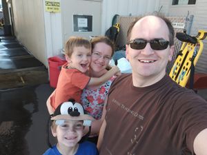
| − | + | [[Image:2017-12-29 32 -117 Grins.jpg|thumb|left]] | |
| − | |||
| − | |||
| − | |||
| − | |||
| − | |||
| − | |||
| − | |||
{{meetup graticule | {{meetup graticule | ||
| lat=32 | | lat=32 | ||
| Line 14: | Line 7: | ||
}} | }} | ||
| − | |||
__NOTOC__ | __NOTOC__ | ||
| Line 34: | Line 26: | ||
--> | --> | ||
<gallery perrow="5"> | <gallery perrow="5"> | ||
| + | Image:2017-12-29 32 -117 Grins.jpg | Grins | ||
</gallery> | </gallery> | ||
[[Category:Expeditions]] | [[Category:Expeditions]] | ||
| − | |||
| − | |||
[[Category:Expeditions with photos]] | [[Category:Expeditions with photos]] | ||
| − | |||
| − | |||
| − | |||
| − | |||
[[Category:Coordinates reached]] | [[Category:Coordinates reached]] | ||
Revision as of 04:39, 10 September 2018
| Fri 29 Dec 2017 in 32,-117: 32.8216998, -117.1377186 geohashing.info google osm bing/os kml crox |
Location
Behind the American Medical Response Building in northern San Diego
Participants
Plans
- Head out there, see if it's accessible, and do the hash
Expedition
- We drove through the area, but all of the parking was marked as for emergency use or something like that, so we parked nearby in the college parking lot. Then we walked over.

