Difference between revisions of "2018-10-13 52 13"
imported>Danatar ([live] Reached. It's dark and I don't See anything. No grave here though.) |
imported>FippeBot m (Location) |
||
| (2 intermediate revisions by one other user not shown) | |||
| Line 1: | Line 1: | ||
| − | + | {{meetup graticule | |
| − | |||
| − | |||
| − | |||
| − | |||
| − | |||
| − | |||
| − | |||
| − | |||
| − | |||
| − | {{meetup graticule | ||
| lat=52 | | lat=52 | ||
| lon=13 | | lon=13 | ||
| date=2018-10-13 | | date=2018-10-13 | ||
| − | }} | + | | graticule_name=Berlin |
| − | + | | graticule_link=Berlin, Germany | |
| − | + | }}__NOTOC__ | |
| − | __NOTOC__ | ||
== Location == | == Location == | ||
| − | + | Today's location is in the Georgen-Parochial-Gemeinde-Friedhof I (a parish cemetery) in the middle of Berlin. | |
| − | + | Country: Germany; state: Berlin (EU:DE:BE); city district: Prenzlauer Berg | |
| − | |||
| − | |||
| − | |||
| − | |||
| − | == Expedition == | + | == Expedition== |
| − | + | ===[[User:Danatar|Danatar]]=== | |
| + | I was in Berlin for a workshop from Friday to Sunday and the hashpoint fell right in the middle of the city in a reachable spot. | ||
| + | *I plan to visit the hashpoint in the evening. My workshop officially ends at 7, the cemetery closes at 8. Danatar -- [[User:Danatar|Danatar]] ([[User talk:Danatar|talk]]) 08:55, 13 October 2018 (GMT+02:00) | ||
| − | + | At the end of the second day's session I boarded the subway at ''Osloer Straße'' and rode to ''Rosenthaler Platz'', changing to a bus for two stops. Then I walked along the Nicolai-and-Mary cemetery until I reached the George-parish cemetery. At first I walked into a dead-end driveway but then I found the sign pointing to the entrance. In the cemetery I just had to walk down one path to reach the spot. It was in a place not used for graves (any more?) with some small overgrowth, the next graves were a few meters away. I had to walk around a bit to get the coordinates right. | |
*Reached. It's dark and I don't See anything. No grave here though. -- [[User:Danatar|Danatar]] ([[User talk:Danatar|talk]]) [http://www.openstreetmap.org/?lat=52.52941960&lon=13.42176530&zoom=16&layers=B000FTF @52.5294,13.4218] 19:40, 13 October 2018 (GMT+02:00) | *Reached. It's dark and I don't See anything. No grave here though. -- [[User:Danatar|Danatar]] ([[User talk:Danatar|talk]]) [http://www.openstreetmap.org/?lat=52.52941960&lon=13.42176530&zoom=16&layers=B000FTF @52.5294,13.4218] 19:40, 13 October 2018 (GMT+02:00) | ||
| − | |||
| − | |||
| − | + | Then I left the cemetery and started my way back by tramway. I noticed I was near [[wikipedia:Alexanderplatz|Alexanderplatz]] so I went there for a bit of shopping before taking another subway back to the hotel. | |
| − | + | ||
| − | + | When my workshop ended the next day I made a short stop at the cemetery (and at the gas station next to it) to get some pictures in daylight. I couldn't take a panorama picture because a woman was breastfeeding a few meters away. | |
| − | |||
| − | |||
| − | |||
| − | |||
| − | |||
| − | |||
| − | + | {{gallery|width=200|height=200|lines=2 | |
| − | + | |Image:2018-10-13_52_13_ubahn.jpg|subway | |
| − | + | |Image:2018-10-13_52_13_eingang.jpg|entrance to cemetery | |
| + | |Image:2018-10-13_52_13_gps.jpg|GPS | ||
| + | |Image:2018-10-13_52_13_spot.jpg|the hashpoint | ||
| + | |Image:2018-10-13_52_13_barnbeck.jpg|nearest grave (~5 m) | ||
| + | |Image:2018-10-13_52_13_tag.jpg|cemetery the next day | ||
| + | |Image:2018-10-13_52_13_tag-spot.jpg|hashpoint in daylight | ||
| + | }} | ||
| − | |||
| − | |||
| − | |||
| − | |||
| − | |||
| − | + | ===tracklog=== | |
| + | [https://dl.dropboxusercontent.com/sh/l38ubdidvmv439v/AACv1vbWyoWUdVWc4OkYSIM4a/2018/2018-10-13_52_13-triton.gpx triton tracklog] | ||
| − | |||
[[Category:Expeditions]] | [[Category:Expeditions]] | ||
| − | |||
[[Category:Expeditions with photos]] | [[Category:Expeditions with photos]] | ||
| − | |||
| − | |||
| − | |||
| − | |||
| − | |||
[[Category:Coordinates reached]] | [[Category:Coordinates reached]] | ||
| − | + | [[Category:Danatar]] | |
| − | + | {{location|DE|BE}} | |
| − | |||
| − | |||
| − | |||
| − | |||
| − | |||
| − | |||
| − | |||
| − | |||
| − | |||
| − | |||
| − | [[Category: | ||
| − | |||
| − | |||
| − | |||
| − | |||
| − | |||
Latest revision as of 04:11, 16 August 2019
| Sat 13 Oct 2018 in Berlin: 52.5294197, 13.4217653 geohashing.info google osm bing/os kml crox |
Location
Today's location is in the Georgen-Parochial-Gemeinde-Friedhof I (a parish cemetery) in the middle of Berlin.
Country: Germany; state: Berlin (EU:DE:BE); city district: Prenzlauer Berg
Expedition
Danatar
I was in Berlin for a workshop from Friday to Sunday and the hashpoint fell right in the middle of the city in a reachable spot.
- I plan to visit the hashpoint in the evening. My workshop officially ends at 7, the cemetery closes at 8. Danatar -- Danatar (talk) 08:55, 13 October 2018 (GMT+02:00)
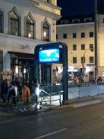
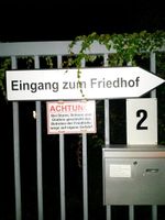
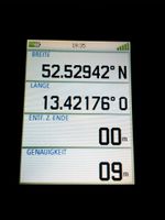
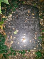
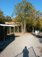
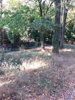
At the end of the second day's session I boarded the subway at Osloer Straße and rode to Rosenthaler Platz, changing to a bus for two stops. Then I walked along the Nicolai-and-Mary cemetery until I reached the George-parish cemetery. At first I walked into a dead-end driveway but then I found the sign pointing to the entrance. In the cemetery I just had to walk down one path to reach the spot. It was in a place not used for graves (any more?) with some small overgrowth, the next graves were a few meters away. I had to walk around a bit to get the coordinates right.
- Reached. It's dark and I don't See anything. No grave here though. -- Danatar (talk) @52.5294,13.4218 19:40, 13 October 2018 (GMT+02:00)
Then I left the cemetery and started my way back by tramway. I noticed I was near Alexanderplatz so I went there for a bit of shopping before taking another subway back to the hotel.
When my workshop ended the next day I made a short stop at the cemetery (and at the gas station next to it) to get some pictures in daylight. I couldn't take a panorama picture because a woman was breastfeeding a few meters away.
|
