Difference between revisions of "2020-02-08 43 -79"
From Geohashing
| Line 18: | Line 18: | ||
=== [[User:SIGSTKFLT|SIGSTKFLT]] === | === [[User:SIGSTKFLT|SIGSTKFLT]] === | ||
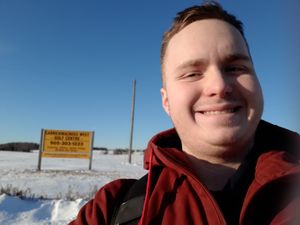
[[File:2020-02-08_43_-79_SIGSTKFLT-stupidgrin.jpg|thumb|right|Stupid Grin™ near the hashpoint]] | [[File:2020-02-08_43_-79_SIGSTKFLT-stupidgrin.jpg|thumb|right|Stupid Grin™ near the hashpoint]] | ||
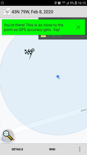
| + | [[File:2020-02-08_43_-79_SIGSTKFLT-proof.jpg|thumb|right|''CLOSE ENOUGH'']] | ||
Left around 1, took buses to Keele & Kirby. Hiked it to the hashpoint. | Left around 1, took buses to Keele & Kirby. Hiked it to the hashpoint. | ||
Hashpoint was covered in about a meter of snow, and not packed enough to walk on. Did it anyways. | Hashpoint was covered in about a meter of snow, and not packed enough to walk on. Did it anyways. | ||
Revision as of 15:15, 9 February 2020
| Sat 8 Feb 2020 in Toronto: 43.8906090, -79.5267114 geohashing.info google osm bing/os kml crox |
Participants
Location
Just beside Kirby road.
Plans
Expeditions
SIGSTKFLT
Left around 1, took buses to Keele & Kirby. Hiked it to the hashpoint.
Hashpoint was covered in about a meter of snow, and not packed enough to walk on. Did it anyways.

