Difference between revisions of "2008-06-14 55 13"
imported>Thomcat (Success/failure category added) |
imported>ReletBot m (Failed => Not reached) |
||
| Line 23: | Line 23: | ||
Image:2008-06-14_55_13_11.jpg|Close to the point was "Karaby backar", which is some kind of Viking thing. Note the rune stone on the second hill from the left. | Image:2008-06-14_55_13_11.jpg|Close to the point was "Karaby backar", which is some kind of Viking thing. Note the rune stone on the second hill from the left. | ||
</gallery> | </gallery> | ||
| + | <!-- presume the spot was not reached from the description --> | ||
[[Category:Expeditions]] | [[Category:Expeditions]] | ||
[[Category:Expeditions with photos]] | [[Category:Expeditions with photos]] | ||
[[Category:Coordinates not reached]] | [[Category:Coordinates not reached]] | ||
| − | [[Category: | + | [[Category:Not reached - No public access]] |
| − | |||
Revision as of 20:28, 31 March 2009
| Sat 14 Jun 2008 in 55,13: 55.8067463, 13.0388869 geohashing.info google osm bing/os kml crox |
About
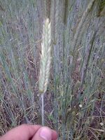
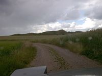
This hash in the Malmö, Sweden graticule was located in Västra Karaby in a field behind someone's back yard... Was a bit tricky to get closer than 200 meters. GPS: (55.806746324522N, 13.0388868587671E). Just like two other times, the point was in a field of some sort. Must look up what the crop is called. Could it be wheat?
Update: Yes! it is wheat!
You see an Aerial view here.
The Meetup
HannesL enjoyed the drive there. Per enjoyed the ride and the "Folköl" (people's beer, ie. not very strong beer).
- Photo Gallery
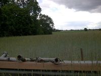
There about 150 meters up, under the trees was the geohash point.
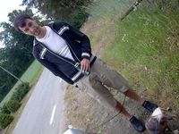
Per watching the dogs and enjoying some "Folköl"
This is what grows here... Three out of five points reached this far has been in this kind of field...
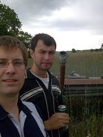
]]'s and Per's heads.
Close to the point was "Karaby backar", which is some kind of Viking thing. Note the rune stone on the second hill from the left.


