Difference between revisions of "2008-06-19 42 -71"
imported>Ahecht |
imported>Thomcat m (Boston rename) |
||
| Line 9: | Line 9: | ||
[http://maps.google.com/maps?q=42.844501N%2C%2071.686917W 42.844501N, 71.686917W] | [http://maps.google.com/maps?q=42.844501N%2C%2071.686917W 42.844501N, 71.686917W] | ||
| − | This hash is located in Milford, NH near the Greenville border in the [[ | + | This hash is located in Milford, NH near the Greenville border in the [[Boston, Massachusetts]] graticule in a field north of 101A west of the oval. Most likely private property. |
{{No tresspassing geohash | {{No tresspassing geohash | ||
Revision as of 19:01, 30 July 2008
| Thu 19 Jun 2008 in 42,-71: 42.8445014, -71.6869165 geohashing.info google osm bing/os kml crox |
About
This hash is located in Milford, NH near the Greenville border in the Boston, Massachusetts graticule in a field north of 101A west of the oval. Most likely private property.
Template:No tresspassing geohash
Expeditions
No one has reached this geohash yet!
Failed Expeditions
AHecht 8:11pm EDT
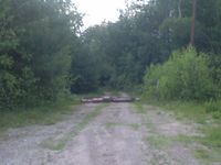
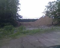
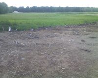
This is the second geohash I've attempted that was adjacent to the Souhegan River, but this time I was unsuccessful. I tried to reach this hash after work, but found that it was on private property and, despite the dirt road shown on Google Maps, inaccessible by car. I got about 1/5 of a mile away and found that the road was deliberately blocked by a couple of logs, so I decided to go no further. There was a nearby hill I could climb to get a view of the field with the geohash in it, so I climbed up there and snapped a picture just as the sun was setting. Sorry for the lousy pics, I didn't have a real camera with me and had to use my phone.
- Boston 06-19-08: AHecht


