Difference between revisions of "2008-06-24 -37 144"
From Geohashing
imported>Urcher (New page: {{meetup graticule | map=<map lat="-37" lon="144" date="2008-06-24" /> | lat=-37 | lon=144 | date=2008-06-24 }} == About == Median strip of the Calder Freeway not far out of Melbourne. ...) |
imported>Thomcat (Success/failure category added) |
||
| Line 15: | Line 15: | ||
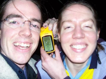
[[Image:Urcher_and_Bilby_2008-06-24.jpg|thumb|left|360px|Can you tell which way the wind was blowing?]] | [[Image:Urcher_and_Bilby_2008-06-24.jpg|thumb|left|360px|Can you tell which way the wind was blowing?]] | ||
| + | |||
| + | [[Category:Expeditions]] | ||
| + | [[Category:Expeditions with photos]] | ||
| + | [[Category:Coordinates reached]] | ||
Revision as of 16:10, 11 August 2008
| Tue 24 Jun 2008 in -37,144: -37.6568556, 144.7411095 geohashing.info google osm bing/os kml crox |
About
Median strip of the Calder Freeway not far out of Melbourne.
Plan
Urcher: Didn't plan to go until Bilby, my wife, mentioned to me that today's hash point wasn't too far from our place, drove out at about 9pm, no photos of the scenery because it was dark.
