Difference between revisions of "2018-11-27 31 34"
From Geohashing
imported>Yosef |
(→Photos) |
||
| (7 intermediate revisions by 4 users not shown) | |||
| Line 15: | Line 15: | ||
}} | }} | ||
| − | + | ||
__NOTOC__ | __NOTOC__ | ||
== Location == | == Location == | ||
| − | + | ||
| + | Masmiya Junction, on a harvested onion field near Kfar haRif | ||
== Participants == | == Participants == | ||
| − | + | ||
| − | + | * [[User:Yosef|Yosef]] | |
== Plans == | == Plans == | ||
<!-- what were the original plans --> | <!-- what were the original plans --> | ||
| + | Park at a gas station on the way to work and walk/run to the hash. | ||
== Expedition == | == Expedition == | ||
<!-- how it all turned out. your narrative goes here. --> | <!-- how it all turned out. your narrative goes here. --> | ||
| + | It turned out to be in an onion field that had just been harvested. | ||
== Tracklog == | == Tracklog == | ||
| Line 39: | Line 42: | ||
--> | --> | ||
<gallery perrow="5"> | <gallery perrow="5"> | ||
| + | Image: Screenshot 2018-11-27-08-45-49.png | proof | ||
</gallery> | </gallery> | ||
| Line 45: | Line 49: | ||
<!-- Add any achievement ribbons you earned below, or remove this section --> | <!-- Add any achievement ribbons you earned below, or remove this section --> | ||
| − | + | * Land Geohash | |
| − | |||
| − | |||
| − | |||
| − | |||
| − | |||
| − | |||
| − | |||
| − | |||
| − | |||
| − | |||
| − | |||
| − | |||
[[Category:Expeditions]] | [[Category:Expeditions]] | ||
| − | + | [[Category:Coordinates reached]] | |
| − | + | {{location|IL|D|AS}} | |
| − | |||
| − | |||
| − | |||
| − | [[Category:Coordinates reached]] | ||
| − | |||
| − | |||
| − | |||
| − | |||
| − | |||
| − | |||
| − | |||
| − | |||
| − | |||
| − | |||
| − | |||
| − | |||
| − | |||
| − | |||
| − | |||
| − | |||
| − | |||
| − | |||
| − | |||
| − | |||
Latest revision as of 21:34, 23 April 2020
| Tue 27 Nov 2018 in 31,34: 31.7538090, 34.7805683 geohashing.info google osm bing/os kml crox |
Location
Masmiya Junction, on a harvested onion field near Kfar haRif
Participants
Plans
Park at a gas station on the way to work and walk/run to the hash.
Expedition
It turned out to be in an onion field that had just been harvested.
Tracklog
Photos
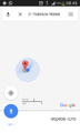
proof

Achievements
- Land Geohash