Difference between revisions of "2018-11-11 31 34"
From Geohashing
(→Plans) |
(→Location) |
||
| (2 intermediate revisions by the same user not shown) | |||
| Line 21: | Line 21: | ||
<!-- where you've surveyed the hash to be --> | <!-- where you've surveyed the hash to be --> | ||
| − | Near the Cave of Horses | + | Near the Cave of Horses, Beit Guvrin |
== Participants == | == Participants == | ||
| Line 35: | Line 35: | ||
== Expedition == | == Expedition == | ||
<!-- how it all turned out. your narrative goes here. --> | <!-- how it all turned out. your narrative goes here. --> | ||
| + | Close to the highway. Pulled over jumped over to the hash and walked back to the car. Recorded more than a year later. | ||
== Tracklog == | == Tracklog == | ||
| Line 44: | Line 45: | ||
--> | --> | ||
<gallery perrow="5"> | <gallery perrow="5"> | ||
| + | Image: Screenshot 2018-11-11-07-44-13.png| proof | ||
</gallery> | </gallery> | ||
Latest revision as of 21:49, 23 April 2020
| Sun 11 Nov 2018 in 31,34: 31.6008263, 34.8772810 geohashing.info google osm bing/os kml crox |
Location
Near the Cave of Horses, Beit Guvrin
Participants
- User:Yosef ??
Plans
Drive in the morning?
Expedition
Close to the highway. Pulled over jumped over to the hash and walked back to the car. Recorded more than a year later.
Tracklog
Photos
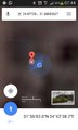
proof

Achievements
- Land Geohashing