Difference between revisions of "2009-08-31 39 -104"
From Geohashing
imported>Cedarm (Replacing page with '{{subst:Expedition |lat = 39 |lon = -104 |date = 2009-08-31 }}') |
|||
| (3 intermediate revisions by 2 users not shown) | |||
| Line 1: | Line 1: | ||
| − | |||
| − | |||
<!-- | <!-- | ||
[[Image:{{{image|IMAGE}}}|thumb|left]] | [[Image:{{{image|IMAGE}}}|thumb|left]] | ||
| Line 8: | Line 6: | ||
| lon=-104 | | lon=-104 | ||
| date=2009-08-31 | | date=2009-08-31 | ||
| + | | graticule_name=Denver East, Colorado | ||
| + | | graticule_link=Denver East, Colorado | ||
}} | }} | ||
| Line 13: | Line 13: | ||
__NOTOC__ | __NOTOC__ | ||
== Location == | == Location == | ||
| − | + | Toepfer Park | |
== Participants == | == Participants == | ||
| − | + | *[[User:CedarM|Cedar Myers]] | |
| + | *Jennifer Myers | ||
| + | *Rachael Myers | ||
| + | *Obed Myers | ||
== Plans == | == Plans == | ||
| − | + | Get food, meet, eat. | |
== Expedition == | == Expedition == | ||
| − | == | + | == Achievements == |
| − | + | {{Picnic_geohash | latitude = 39 | longitude = -104 | date=2009-08-31 | name = [[User:CedarM|Cedar]], Jennifer, Rachael and Obed Myers | image = 2009-08-31 39 -104 spoons.JPG | food = Chinese take-out with baby spoons }} | |
== Photos == | == Photos == | ||
| − | |||
| − | |||
| − | |||
| − | |||
| − | |||
| − | |||
<gallery perrow="3"> | <gallery perrow="3"> | ||
| − | + | Image:2009-08-31 39 -104 thereyet.JPG | Are we there yet? | |
| + | Image:2009-08-31 39 -104 gps.JPG | GPS at hash point | ||
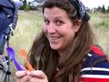
| + | Image:2009-08-31 39 -104 obed.JPG | I'm happy, I have food! | ||
| + | Image:2009-08-31 39 -104 spoons.JPG | Spoons! (And a fork) | ||
| + | Image:2009-08-31 39 -104 view1.JPG | The view. | ||
| + | Image:2009-08-31 39 -104 view2.JPG | Another angle. | ||
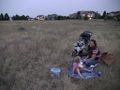
| + | Image:2009-08-31 39 -104 food.JPG | The food. | ||
| + | Image:2009-08-31 39 -104 grin12.JPG | Stupid grin #1 and #2. | ||
| + | Image:2009-08-31 39 -104 grin34.JPG | Stupid grin #3 and #4. | ||
</gallery> | </gallery> | ||
| − | |||
| − | |||
| − | |||
| − | |||
| − | |||
| − | |||
| − | |||
[[Category:Expeditions]] | [[Category:Expeditions]] | ||
| − | |||
[[Category:Expeditions with photos]] | [[Category:Expeditions with photos]] | ||
| − | |||
| − | |||
| − | |||
| − | |||
| − | |||
[[Category:Coordinates reached]] | [[Category:Coordinates reached]] | ||
| − | + | {{location|US|CO|DU}} | |
| − | |||
| − | |||
| − | |||
| − | |||
| − | |||
| − | |||
| − | |||
| − | |||
| − | |||
Latest revision as of 14:44, 29 January 2021
| Mon 31 Aug 2009 in Denver East, Colorado: 39.5465562, -104.9600685 geohashing.info google osm bing/os kml crox |
Location
Toepfer Park
Participants
- Cedar Myers
- Jennifer Myers
- Rachael Myers
- Obed Myers
Plans
Get food, meet, eat.
Expedition
Achievements
Cedar, Jennifer, Rachael and Obed Myers earned the Picnic achievement
|
Photos

Are we there yet?
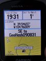
GPS at hash point

I'm happy, I have food!
Spoons! (And a fork)
The view.
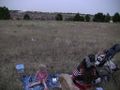
Another angle.
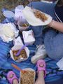
The food.

Stupid grin #1 and #2.
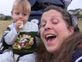
Stupid grin #3 and #4.


