Difference between revisions of "2021-02-16 32 -96"
(→Photos) |
m (Location) |
||
| (3 intermediate revisions by 2 users not shown) | |||
| Line 1: | Line 1: | ||
| − | + | {{meetup graticule | |
| − | |||
| − | |||
| − | |||
| − | |||
| − | |||
| − | |||
| − | |||
| − | |||
| lat=32 | | lat=32 | ||
| lon=-96 | | lon=-96 | ||
| date=2021-02-16 | | date=2021-02-16 | ||
| − | }} | + | }} |
__NOTOC__ | __NOTOC__ | ||
== Location == | == Location == | ||
| Line 56: | Line 48: | ||
<!-- Add any achievement ribbons you earned below, or remove this section --> | <!-- Add any achievement ribbons you earned below, or remove this section --> | ||
| − | + | {{land geohash | latitude = 32 | longitude = -96 | date = 2021-02-16 | name = Gabe | image = 2021-02-16 32 -96 04.jpg }} | |
| − | |||
| − | |||
| − | + | {{Frozen Geohash | |
| − | |||
| − | |||
| − | |||
| − | |||
| − | |||
| − | + | | latitude = 32 | |
| + | | longitude = -96 | ||
| + | | date = 2021-02-16 | ||
| + | | temperature = 18°F | ||
| + | | name = Gabe | ||
| + | | image = 2021-02-16 32 -96 06.png | ||
| + | }} | ||
| − | |||
[[Category:Expeditions]] | [[Category:Expeditions]] | ||
| − | |||
[[Category:Expeditions with photos]] | [[Category:Expeditions with photos]] | ||
| − | |||
| − | |||
| − | |||
| − | |||
| − | |||
| − | |||
| − | |||
| − | |||
| − | |||
[[Category:Coordinates not reached]] | [[Category:Coordinates not reached]] | ||
| − | |||
| − | |||
| − | |||
| − | |||
| − | |||
[[Category:Not reached - No public access]] | [[Category:Not reached - No public access]] | ||
| − | + | {{location|US|TX|DS}} | |
| − | |||
| − | |||
| − | |||
| − | |||
| − | |||
| − | |||
| − | |||
Latest revision as of 13:42, 20 February 2021
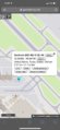
| Tue 16 Feb 2021 in 32,-96: 32.8456840, -96.8472644 geohashing.info google osm bing/os kml crox |
Location
On the property of the Dallas Love Field airport. Exact hash location outside of the terminal and thus unreachable.
what3words: ///socket.chins.blaze (what is this?)
Participants
Plans
Had planned a flight from PHX to DAL. Was elated to discover that the daily hash was located on airport property. The plan was made to attempt the closest possible approach without being arrested.
Expedition
Unfortunately, the hash was not inside the terminal and was thus unable to be reached exactly. The closest (legal) approach was found to be at a distance of 279 ft.
Additional Note
The expedition was made all the more exciting as it took place during an extreme episode of winter weather. Was retrieved by Luke following the hash, at which point we drove extremely slowly over snow and ice back to the safety of his apartment.
Photos
Hash location just outside of terminal

Closest approach

Measured at 279 ft from hash

At hash location inside Love Field airport

Airport was very empty


Achievements
Gabe earned the Land geohash achievement
|

