Difference between revisions of "2012-10-09 25 -80"
imported>DrCanadianNinja |
m |
||
| (2 intermediate revisions by 2 users not shown) | |||
| Line 1: | Line 1: | ||
| + | {{Advert}} | ||
| + | |||
{{meetup graticule | {{meetup graticule | ||
| map=<map lat="25" lon="-80" date="2012-10-09" /> | | map=<map lat="25" lon="-80" date="2012-10-09" /> | ||
| Line 12: | Line 14: | ||
On a sidewalk on Prairie Ave on Miami Beach. | On a sidewalk on Prairie Ave on Miami Beach. | ||
| − | [[user: | + | [[user:Geoffistopheles|Geoff]] and [[user:NinjaBait|Erica]] are driving back to Tampa from Key West, planning on making this stop between 1:30 and 2:00, depending on traffic. |
=== Geohashers === | === Geohashers === | ||
| − | * [[user: | + | * [[user:Geoffistopheles|Geoff]] |
* [[user:NinjaBait|Erica]] | * [[user:NinjaBait|Erica]] | ||
| Line 45: | Line 47: | ||
[[Category:Expeditions with photos]] | [[Category:Expeditions with photos]] | ||
[[Category:Coordinates reached]] | [[Category:Coordinates reached]] | ||
| + | {{location|US|FL|DA}} | ||
Latest revision as of 17:02, 24 March 2021
| Have you seen our geohashing marker? We'd love to hear from you! Click here to say "hi" and tell us what you've seen!
Curious about what geohashing is? Read more! |
| Tue 9 Oct 2012 in Miami Beach, Florida: 25.8067439, -80.1316724 geohashing.info google osm bing/os kml crox |
Expedition
The Plan
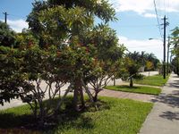
On a sidewalk on Prairie Ave on Miami Beach.
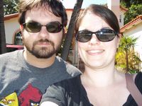
Geoff and Erica are driving back to Tampa from Key West, planning on making this stop between 1:30 and 2:00, depending on traffic.
Geohashers
The Adventure
We were already in Key West for the weekend, so it was on the way back as we returned to Palm Harbor for the second half of our vacation. The worst of it is just driving out of the Keys; takes a solid two and a half hours. After hitting some absolutely dreadful Miami traffic (note to self, damn you Miami) we finally got to I-95, then back off to Miami Beach.
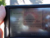
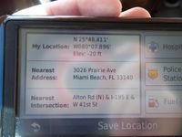
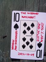
Something about Erica's GPS is strange as all hell - it gets to the point just fine, but once you get there, it refuses to update. We can get really close, but it never gets directly to the point. Last time, this was because the GPS got no reception in Cordele, Georgia; this time, we had full reception and nothing happened. We would've gone back for my GPS, but with another five hours to be on the road, I didn't want to waste too much time. Thankfully, we determined that north/south was just up and down the driveway, while east/west put it just into someone's driveway. Pretty certain I reached it! Turned out when the GPS started giving accurate information again, we were 20 feet below sea level. Turns out I almost challenged my own Low Geohash record! We left the Ten of Spades on a nearby phone pole.
As we left, our luck did not abandon us, and the skies quickly turned dark and raining, robbing us once again of a Drowned Rat achievement. We drove back the way we came and followed the GPS back to Palm Harbor. That turned out to be a mistake - where a reasonable person would take a combination of I-95, 595 and 75 in order to keep food, gas, and a decent pace at hand, the GPS had us cut through more local streets, leading to a backup just sitting in the rain for quite some time. The GPS knows the shortest route, but it is not necessarily the correct route!
After that, we drove through Alligator Alley and followed the road back to Palm Harbor. On the way back, we saw what is quite possibly the crappiest name for a bus transit system.
Gallery
- Photo Gallery
Achieveables
We drove 169 miles to get from Key West to the geohash, but I'm a bit reluctant to award myself the XKCD-100 Honorable Mention as it was only 6 miles out of the way I was already going.
